MyTopo
Council Arkansas US Topo Map
Couldn't load pickup availability
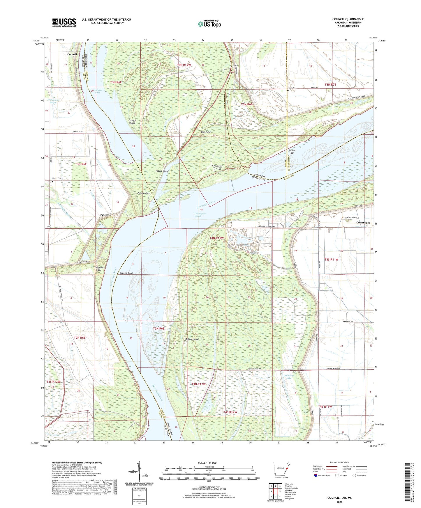
2024 topographic map quadrangle Council in the states of Arkansas, Mississippi. Scale: 1:24000. Based on the newly updated USGS 7.5' US Topo map series, this map is in the following counties: Lee, Tunica, Crittenden. The map contains contour data, water features, and other items you are used to seeing on USGS maps, but also has updated roads and other features. This is the next generation of topographic maps. Printed on high-quality waterproof paper with UV fade-resistant inks.
Quads adjacent to this one:
West: Brickeys
Northwest: Mud Lake
North: Hughes
Northeast: Horseshoe Lake
East: Robinsonville
Southeast: Hollywood
South: Tunica
Southwest: Stubbs Island
Contains the following named places: Anderson Farm, Ashley Point, Ashley Point Lodge, Basket Bar, Basket Bar Dikes, Blue Point, Blue Point Farm, Campbell Bar, Cistern Hill Church, Clark Towhead, Commerce Cut Off, Commerce Cutoff, Commerce Landing, Commerce Revetment, Council, Council Bend, Council Island, Diamond Woods, Gospel Temple, Happy Cemetery, Happy Church, Hopewell Church, Hopewell School, Lady Lee-Campbell Landing, Mac Towhead, McDaniels Farm, McPete School, Midway Lake, Mount Olive Church, New Mount Zion School, Old River Lake, Perry Farm, Peters, Peters Cemetery, Peters Church, Peters Island, Peters Landing, Peters Revetment, Polk Landing, Porter Lake Revetment, Rabbit Island, Rosenwald School, Supervisor District 4, Township of Council