MyTopo
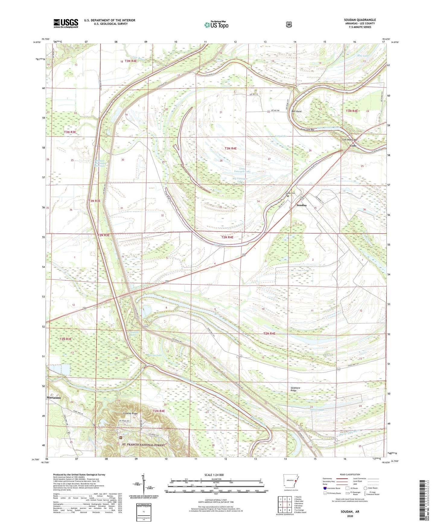
Soudan Arkansas US Topo Map
Couldn't load pickup availability
Also explore the Soudan Forest Service Topo of this same quad for updated USFS data
2024 topographic map quadrangle Soudan in the state of Arkansas. Scale: 1:24000. Based on the newly updated USGS 7.5' US Topo map series, this map is in the following counties: Lee. The map contains contour data, water features, and other items you are used to seeing on USGS maps, but also has updated roads and other features. This is the next generation of topographic maps. Printed on high-quality waterproof paper with UV fade-resistant inks.
Quads adjacent to this one:
West: Marianna
Northwest: Haynes
North: Dansby
Northeast: Mud Lake
East: Brickeys
Southeast: Stubbs Island
South: La Grange
Southwest: Rondo
This map covers the same area as the classic USGS quad with code o34090g6.
Contains the following named places: Bald Point Church, Bald Point School, Ball Point, Baynes Spur, Big Twin Lake, Big Yancopin Lake, Blue Lake, Cody, Cody School, Corner Place, Cow Bayou, Cow Bayou Bar, Crowley Ridge, Crystal Lake, Crystal Lake Dam, Ellison Lake, Greer Place, Holly Grove Church, Johnson Lake, KVNZ-FM (Marianna), L'Anguille Lake, Larkin Lake, Little Twin Lake, Little Yancopin Lake, Long Lake, Madison-Marianna Diversion, Mossy Lake Bayou, Mount Olive Church, Mount Zion Church, New Bethel Church, New Hope Church, New Mount Olive Church, Patterson Creek, Pleasant Valley Missionary Baptist Church, Poinsett Spur, Rowing Lake, Saint Francis Floodway, Sandy Slough, Shady Grove Church, Shenship Lake, Skidmore Ridge, Skidmore School, Soudan, Soudan Cemetery, Soudan Landing, Soudan School, Three Mile Slough, Tongin School, Township of Independence, Township of Liberty, Township of Union, True Love Bar, True Love Crossing, Vanness Crossing, Westwood School, Willow School