MyTopo
Terry Mississippi US Topo Map
Couldn't load pickup availability
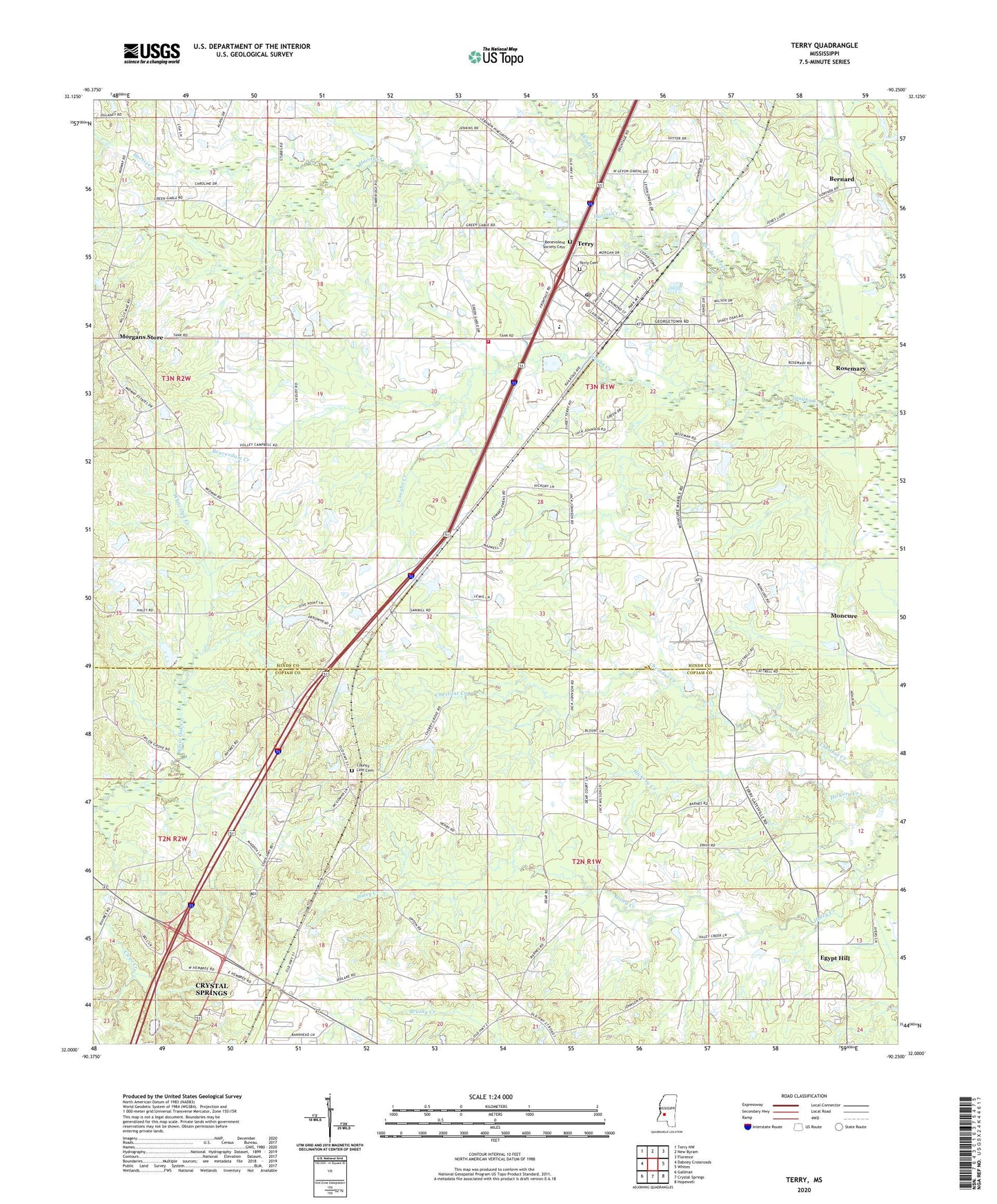
2024 topographic map quadrangle Terry in the state of Mississippi. Scale: 1:24000. Based on the newly updated USGS 7.5' US Topo map series, this map is in the following counties: Hinds, Copiah, Rankin. The map contains contour data, water features, and other items you are used to seeing on USGS maps, but also has updated roads and other features. This is the next generation of topographic maps. Printed on high-quality waterproof paper with UV fade-resistant inks.
Quads adjacent to this one:
West: Dabney Crossroads
Northwest: Terry NW
North: New Byram
Northeast: Florence
East: Whites
Southeast: Hopewell
South: Crystal Springs
Southwest: Gallman
This map covers the same area as the classic USGS quad with code o32090a3.
Contains the following named places: Beaverdam Creek, Benevolent Society Cemetery, Bernard, Berryhill Farms Airport, Christ Sanctified Holy Church, Clear Creek Church, Colils Hill Church of Christ Holiness, County Line Baptist Church, County Line Cemetery, Crystal Springs Lookout Tower, Dixon Lake Dam, Dixon Pond Dam, Egypt Hill, Egypt Hill Baptist Church, Egypt Hill School, Episcopal Church of the Good Shephard, Faith Church, First Baptist Church, George Lake Dam, Harris Creek, J A Parsons Lake Dam, Jesus Name Church, Kennedys Store Post Office, La Bethel Methodist Church, McIntosh School, Moncure, Morgans Store, Mount Pleasant Church, Perryman Elementary School, Pilgrim Rest Baptist Church, Pilgrims Rest Church, Pilgrims Rest School, Rocky Spring Church, Rosemary, Samuels Pond Dam, Sanctified Church, Taylor Grove Church, Terry, Terry Academy, Terry Cemetery, Terry Grove Baptist Church, Terry High School, Terry Methodist Church, Terry Police Department, Terry Post Office, Terry Sanctified Church, Terry Volunteer Fire Department Station 1, Town of Terry, Union Grove Church, Warm Springs Church, ZIP Code: 39170