MyTopo
Terrys Creek Mississippi US Topo Map
Couldn't load pickup availability
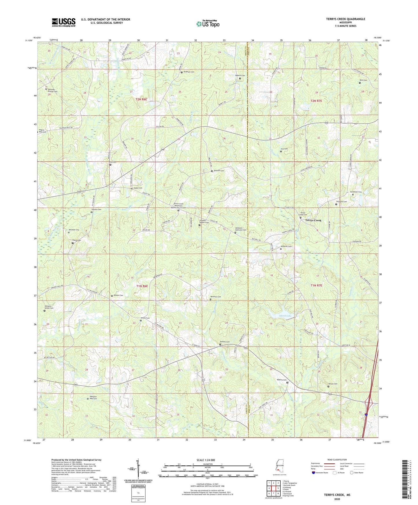
2024 topographic map quadrangle Terrys Creek in the state of Mississippi. Scale: 1:24000. Based on the newly updated USGS 7.5' US Topo map series, this map is in the following counties: Amite, Pike. The map contains contour data, water features, and other items you are used to seeing on USGS maps, but also has updated roads and other features. This is the next generation of topographic maps. Printed on high-quality waterproof paper with UV fade-resistant inks.
Quads adjacent to this one:
West: Gillsburg
Northwest: Peoria
North: Lake Tangipahoa
Northeast: McComb South
East: Osyka
Southeast: Spring Creek
South: Kentwood
Southwest: Liverpool
This map covers the same area as the classic USGS quad with code o31090a5.
Contains the following named places: Alford Lake, Alford Lake Dam, Bond Cemetery, Brabham Cemetery, Breland Branch, Bullock Cemetery, C M Nunnrey Ponds Dam, Crawford Branch, Easley Branch, Easley Cemetery, Gillsburg Oil Field, Gray Coat School, Guy Cemetery, Hampton Wall Cemetery, Hickory Flat School, Lee Lake Dam, McDaniel - McElveen Cemetery, McDaniel Cemetery, Mixon Store, New Star Church, Newman Cemetery, Newman-Phillips Cemetery, Osyka Springs Campground, Parker Mill, Prescott Cemetery, Quin Cemetery, Riceville School, Roberts Cemetery, Simmons Cemetery, Simpson - Raborn Cemetery, Stevens Cemetery, Stevenson Cemetery, Terry Creek Baptist Church, Terrys Creek, Terrys Creek Cemetery, Terrys Creek Church, Terry's Creek Missionary Baptist Church Cemetery, Travis Cemetery, Travis School, Trinity Creek, Webberville School, Williams-Wilson Cemetery, Willson Cemetery, Wilson Cemetery, ZIP Code: 39657