MyTopo
Spring Creek Louisiana US Topo Map
Couldn't load pickup availability
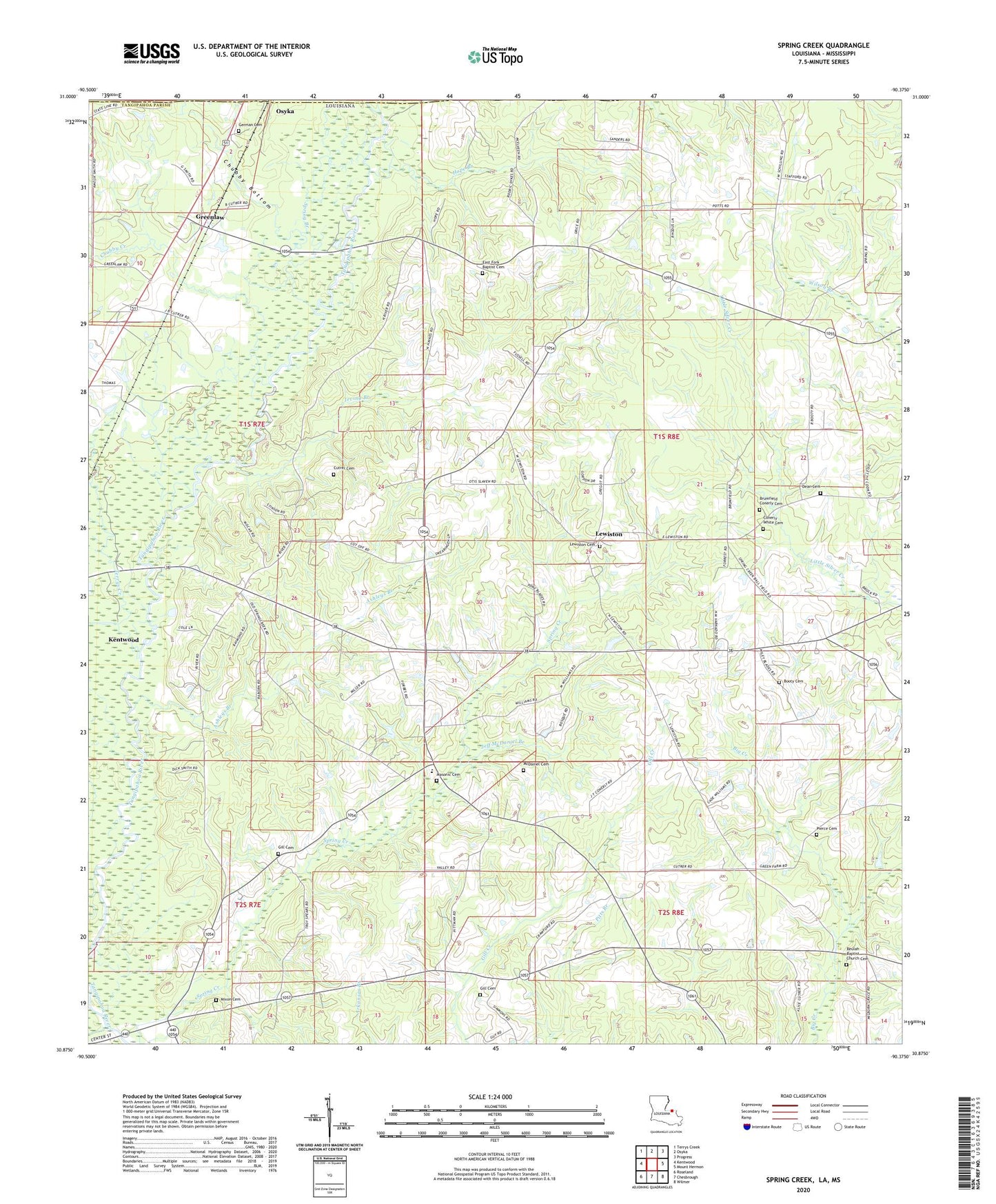
2024 topographic map quadrangle Spring Creek in the states of Louisiana, Mississippi. Scale: 1:24000. Based on the newly updated USGS 7.5' US Topo map series, this map is in the following counties: Tangipahoa, Pike. The map contains contour data, water features, and other items you are used to seeing on USGS maps, but also has updated roads and other features. This is the next generation of topographic maps. Printed on high-quality waterproof paper with UV fade-resistant inks.
Quads adjacent to this one:
West: Kentwood
Northwest: Terrys Creek
North: Osyka
Northeast: Progress
East: Mount Hermon
Southeast: Wilmer
South: Chesbrough
Southwest: Roseland
Contains the following named places: Ashleys Branch, Bala Chitto Creek, Beaver Creek, Beulah Church, Booty Cemetery, Brumfield Conerly Cemetery, Chubby Bottom, Chubby Creek, Conerly White Cemetery, Cool Creek, Cutrer Cemetery, Dean Cemetery, East Fork Baptist Church, First Church, German Cemetery, Gill Cemetery, Greenlaw, Greenlaw Baptist Church, Greenlaw Oil Field, Hagen School, Hope Branch, Irving Branch, Jeff McDaniel Branch, Kirkville, Lewiston, Lewiston Baptist Church, Louisiana Noname 117 Dam, Louisiana Noname 17 Dam, Masonic Cemetery, McDaniel Cemetery, Midway Church, Mixon Cemetery, Parish Governing Authority District 1, Pierce Cemetery, Spring Branch, Spring Creek, Spring Creek Baptist Church, Spring Creek Elementary School, Terrys Creek, Ward Two, ZIP Code: 70444