MyTopo
Three Rivers Mississippi US Topo Map
Couldn't load pickup availability
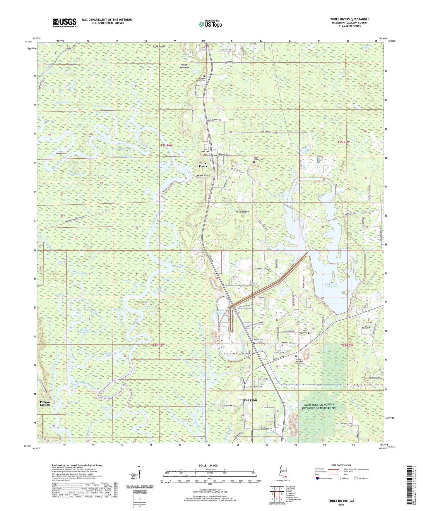
2024 topographic map quadrangle Three Rivers in the state of Mississippi. Scale: 1:24000. Based on the newly updated USGS 7.5' US Topo map series, this map is in the following counties: Jackson. The map contains contour data, water features, and other items you are used to seeing on USGS maps, but also has updated roads and other features. This is the next generation of topographic maps. Printed on high-quality waterproof paper with UV fade-resistant inks.
Quads adjacent to this one:
West: Vancleave
Northwest: Easen Hill
North: Harleston
Northeast: Hurley
East: Big Point
Southeast: Kreole
South: Pascagoula North
Southwest: Gautier North
This map covers the same area as the classic USGS quad with code o30088e5.
Contains the following named places: Apostolic Temple, Ashley Hammock, Barnes Lake, Bear Pond, Big Bear Bayou, Big Island Branch, Big Lake, Big Swamp, Billy Pond, Black Creek, Black Creek Cooling Pond, Black Creek Cooling Water Facility Dam, Black Creek Swamp, Canaan Assembly of God Church, Caswell Lake, Caswell Springs, Caswell Springs Cemetery, Caswell Springs Church, Clark Bayou Church, Coleman Cemetery, Coll Town, Culbert Lake, Cumbest Bluff, Cumbest Bluff Marina, Dads Lake, Davis Chapel Cemetery, Dead River, Fishing Bayou, Gar Lake, Gater Lake, Grace Independent Baptist Church, Gray Bayou, Hackney Lake, Hubbard Lake, Hudson Cemetery, Jacob Branch, Jonican Bayou, Kates Lake, Kates Pond, Kirkwood Lake, Little Bear Bayou, Little Lake, Little River Marina, Long Point, Lower Jerry Lake, Marshall Smith Lake Dam, Melody Lane Church, New Hope Assembly of God Church, New Jerusalem Church of God in Christ, Northeast Jackson County Fire Department Station 5, Northeast Jackson County Fire Department Station 6, Old Dead River, Parish Lake, Parish Lake Bayou, Pasture Fence Bayou, Peafield Bayou, Pinecrest Baptist Church, Poticaw Bayou, Poticaw Fishing Camp, Poticaw Landing, Red Oak Swamp, Rogers Lake, Sams Lake, Sandy Bayou, Sawlog Slough, Serene Memorial Gardens, Shingle Lake, Squeeze Belly Bayou, Supervisor District 1, The Horseshoe, Three Rivers, Three Rivers Assembly of God Church, Three Rivers Cemetery, Upper Jerry Lake, Vaughn Bayou, Ward Bayou, Ware Lake, Wells Church, Wells School, Wolf Ridge Cemetery