MyTopo
Big Point Mississippi US Topo Map
Couldn't load pickup availability
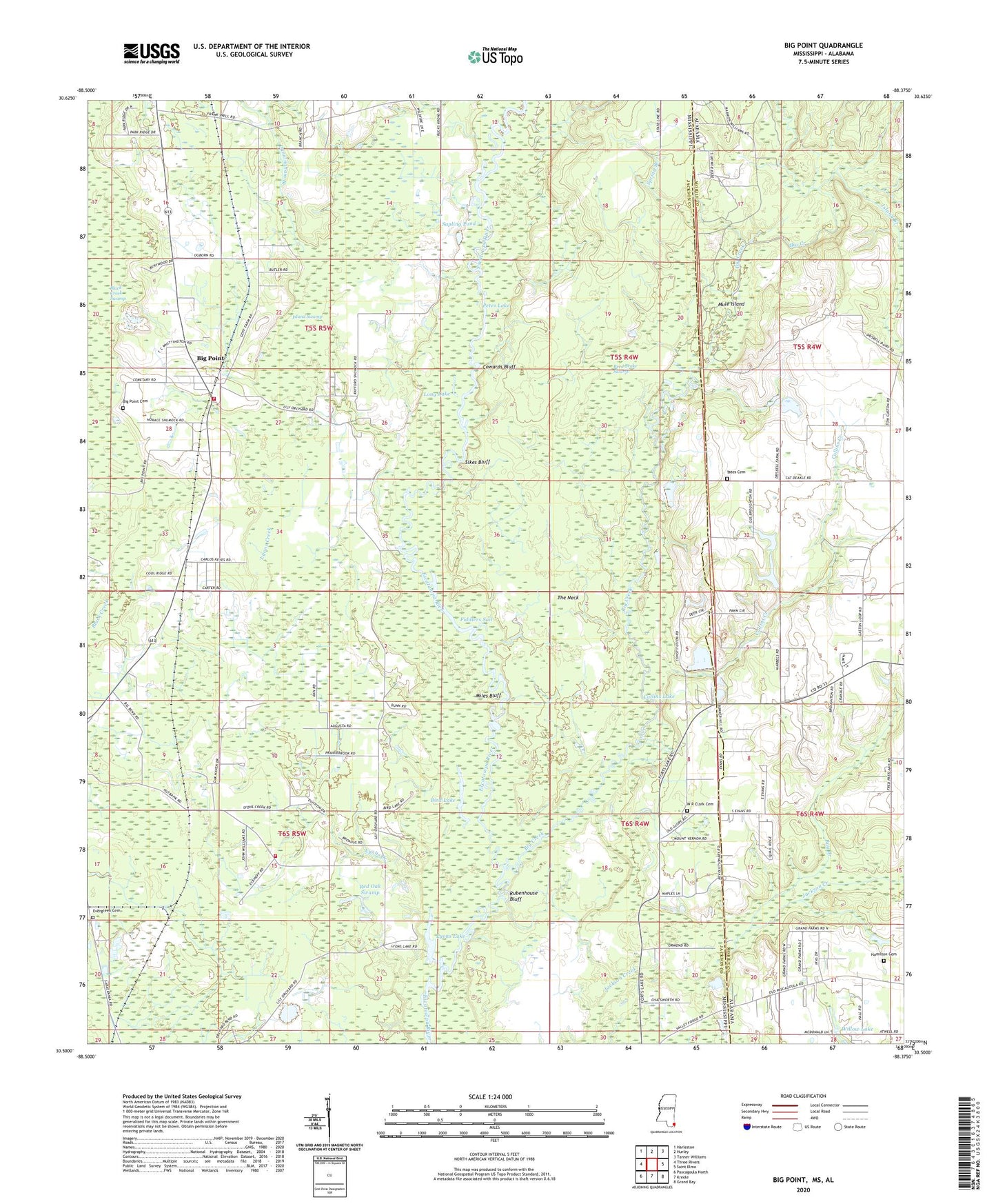
2024 topographic map quadrangle Big Point in the states of Mississippi, Alabama. Scale: 1:24000. Based on the newly updated USGS 7.5' US Topo map series, this map is in the following counties: Jackson, Mobile. The map contains contour data, water features, and other items you are used to seeing on USGS maps, but also has updated roads and other features. This is the next generation of topographic maps. Printed on high-quality waterproof paper with UV fade-resistant inks.
Quads adjacent to this one:
West: Three Rivers
Northwest: Harleston
North: Hurley
Northeast: Tanner Williams
East: Saint Elmo
Southeast: Grand Bay
South: Kreole
Southwest: Pascagoula North
This map covers the same area as the classic USGS quad with code o30088e4.
Contains the following named places: Bay Branch, Big Creek, Big Point, Big Point Cemetery, Big Point Census Designated Place, Big Point Methodist Church, Bird Lake, Church of God, Cloverdale, Collins Creek, Collins Lake, Cowards Bluff, Crandall School, Cunningham Branch, East Central County Golf Course, East Central County Park, Evergreen Cemetery, Fiddlers Sail, Forts Lake Assembly of God Church, Forts Lake Church, Galloway Landing, Goatpen Lake, Hamilton Cemetery, Holy Church of God, Island Branch, Island Swamp, Lily Orchard Church, Long Lake, Lyons Creek, Lyons Lake, Miles Bluff, Miller Creek, Mule Island, Northeast Jackson County Fire Department Station 1, Northeast Jackson County Fire Department Station 3, Nut Bank, Pathyway Baptist Church, Petes Lake, Quail Ridge Park Mobile Home Park, Reed Brake Swamp, Rubenhouse Bluff, Sapling Pond, Sikes Bluff, Simmons Branch, Slaughter Flat Landing, Spring Branch, Tates Cemetery, Temple Baptist Church, The Neck, W R Clark Cemetery, Whispering Pines Golf Course, Willow Lake, ZIP Code: 39562