MyTopo
Tie Plant Mississippi US Topo Map
Couldn't load pickup availability
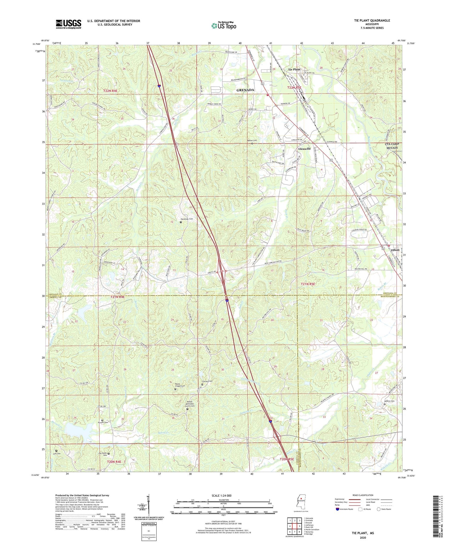
2020 topographic map quadrangle Tie Plant in the state of Mississippi. Scale: 1:24000. Based on the newly updated USGS 7.5' US Topo map series, this map is in the following counties: Grenada, Carroll, Montgomery. The map contains contour data, water features, and other items you are used to seeing on USGS maps, but also has updated roads and other features. This is the next generation of topographic maps. Printed on high-quality waterproof paper with UV fade-resistant inks.
Quads adjacent to this one:
West: Jefferson
Northwest: Holcomb
North: Grenada
Northeast: Kincaid
East: Duck Hill
Southeast: Eskridge
South: McCarley
Southwest: North Carrollton
Contains the following named places: Bethel Cemetery, Bethel Church, Bethel Methodist Church Cemetery, Bolton Branch, Calvary Cemetery, Calvary Church, Calvary School, Collins Gulley Creek, Elliot Church, Elliott Baptist Church, Elliott Census Designated Place, Elliott Church of Christ, Elliott Volunteer Fire Department, Glenwild, Grenada Fire Department Station 3, Hardiman Cemetery, Hardiman Chapel, Jack Creek, Jumping Creek, Lott Cemetery, New Hope Second Baptist Church, Old Salem Cemetery, Payne Chapel Cemetery, Potacocawa Structure Y-31a-34 Dam, Potacocawa Watershed Y-31a-13 Dam, Primitive Church, Purnell Cemetery, Salem Creek, Simpson, Supervisor District 1, Tie Plant, Tie Plant Elementary School, United Church, Wesley Chapel, Wilkins Cemetery, Wilkins Chapel, Williamsville Church