MyTopo
Velma Mississippi US Topo Map
Couldn't load pickup availability
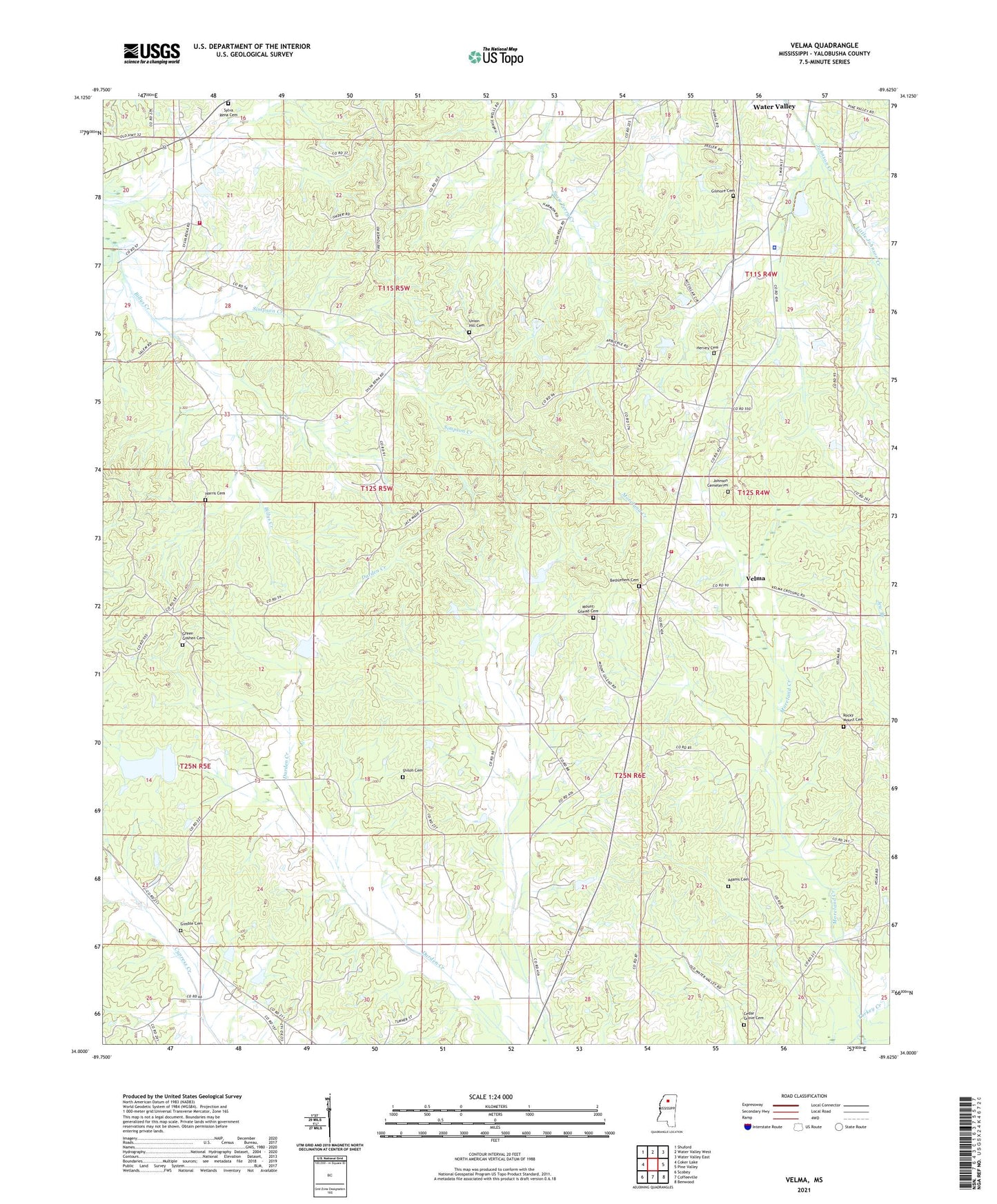
2021 topographic map quadrangle Velma in the state of Mississippi. Scale: 1:24000. Based on the newly updated USGS 7.5' US Topo map series, this map is in the following counties: Yalobusha. The map contains contour data, water features, and other items you are used to seeing on USGS maps, but also has updated roads and other features. This is the next generation of topographic maps. Printed on high-quality waterproof paper with UV fade-resistant inks.
Quads adjacent to this one:
West: Coker Lake
Northwest: Shuford
North: Water Valley West
Northeast: Water Valley East
East: Pine Valley
Southeast: Benwood
South: Coffeeville
Southwest: Scobey
Contains the following named places: Adams Cemetery, Bethlehem Cemetery, Bethlehem Church, Burney Farms Airport, Cedar Grove Cemetery, Gatewood, Gatewood Church, Gilmore Cemetery, Gimble Cemetery, Gray Rock Church, Green Goshen Cemetery, Green Goshen Church, Harris Cemetery, Hervey Cemetery, Johnson Cemeteries, Little Johnson Creek, Moreland Creek, Mount Gilead Cemetery, Mount Gilead Church, Rocky Mount Cemetery, Rocky Mount Church, Shiloh Cemetery, Shiloh Primitive Baptist Church, Shiloh School, Simpson Creek, Smiths Chapel, Sylva Rena Cemetery, Sylva Rena Church, Sylva Rena School, Sylva Rena Volunteer Fire Department, Turkey Creek Watershed Y-20-2 Dam, Turkey Creek Watershed Y-20-63 Dam, Turkey Creek Watershed Y-20-66 Dam, Turkey Creek Watershed Y-20-72 Dam, Union Hill Cemetery, Union Hill Church, Velma, Velma Volunteer Fire Department, Walker Lake Dam, Yalobusha Academy, Yalobusha County, Yalobusha County Sheriff's Office