MyTopo
Hesterville Mississippi US Topo Map
Couldn't load pickup availability
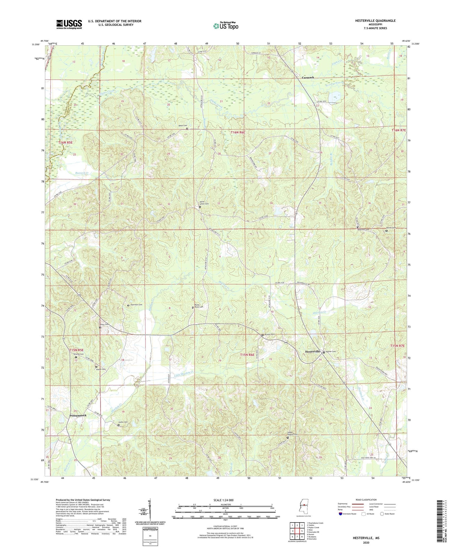
2024 topographic map quadrangle Hesterville in the state of Mississippi. Scale: 1:24000. Based on the newly updated USGS 7.5' US Topo map series, this map is in the following counties: Attala, Carroll, Holmes. The map contains contour data, water features, and other items you are used to seeing on USGS maps, but also has updated roads and other features. This is the next generation of topographic maps. Printed on high-quality waterproof paper with UV fade-resistant inks.
Quads adjacent to this one:
West: West
Northwest: Peachahala Creek
North: Vaiden
Northeast: Poplar Creek
East: Kosciusko NE
Southeast: Kosciusko
South: McAdams
Southwest: Durant
This map covers the same area as the classic USGS quad with code o33089b6.
Contains the following named places: Armstrong Lake Dam, Auris, Baxter Creek, Brister Cemetery, Buzzard Creek, Carmack, Carmack Elementary School, Clark Pond Dam, Dan Oak Dam, Daniel Cemetery, Guess Cemetery, Hesterville, Hesterville Church of Christ, Himan Cemetery, Hudson Creek, Little Sharkey Creek, Mayo Branch, Mayo Cemetery, Mitchells Mill, Mount Harmon School, Mount Herman, North Union, North Union Baptist Church, North Union Cemetery, North Union School, Northwest School, Oakland School, Palmer Cemetery, Possumneck, Possumneck School, Redden Branch, Rock Hill Church, Rocky Point, Rocky Point Cemetery, Rocky Point Church, Rocky Point School, Sand Hill, Sand Hill Baptist Church, Sand Hill Cemetery, Scoobachita Creek, Smyrna Cemetery, Smyrna Methodist Church, Snyders Bluff School, Supervisor District 3, Sweet Pilgrim Cemetery, Sweet Pilgrim Church, Thornton Cemetery, Unity, Unity Baptist Church, Unity Cemetery, Zilpha Creek