MyTopo
White Sand Mississippi US Topo Map
Couldn't load pickup availability
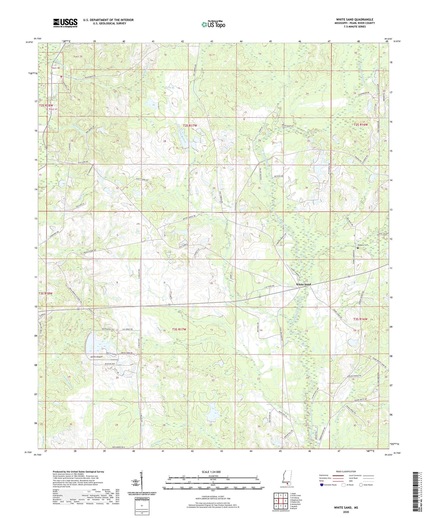
2020 topographic map quadrangle White Sand in the state of Mississippi. Scale: 1:24000. Based on the newly updated USGS 7.5' US Topo map series, this map is in the following counties: Pearl River. The map contains contour data, water features, and other items you are used to seeing on USGS maps, but also has updated roads and other features. This is the next generation of topographic maps. Printed on high-quality waterproof paper with UV fade-resistant inks.
Quads adjacent to this one:
West: Bogalusa East
Northwest: Angie
North: Fords Creek
Northeast: Orvisburg
East: Poplarville
Southeast: Millard
South: McNeill
Southwest: Henleyfield
Contains the following named places: A and G Cafeteria Lake Dam, Amacker Church, Amackertown Volunteer Fire Department Station 1, Buck Branch Lookout Tower, Burkley Burgess Lake Dam, Earl Smith Lake Dam, Glorice P Wills Airport, Holdens Cemetery, Long Branch, Mississippi Agricultural and Forestry Experiment Station, New Bethel Church, Oreck Airport, Pearl River Golf Club, Serenity Missionary Baptist Church, Supervisor District 2, T Wayne Lake Dam, Taylor Land Company Lake Dam, White Sand, White Sand Baptist Church, White Sand Creek, White Sand School