MyTopo
Henleyfield Mississippi US Topo Map
Couldn't load pickup availability
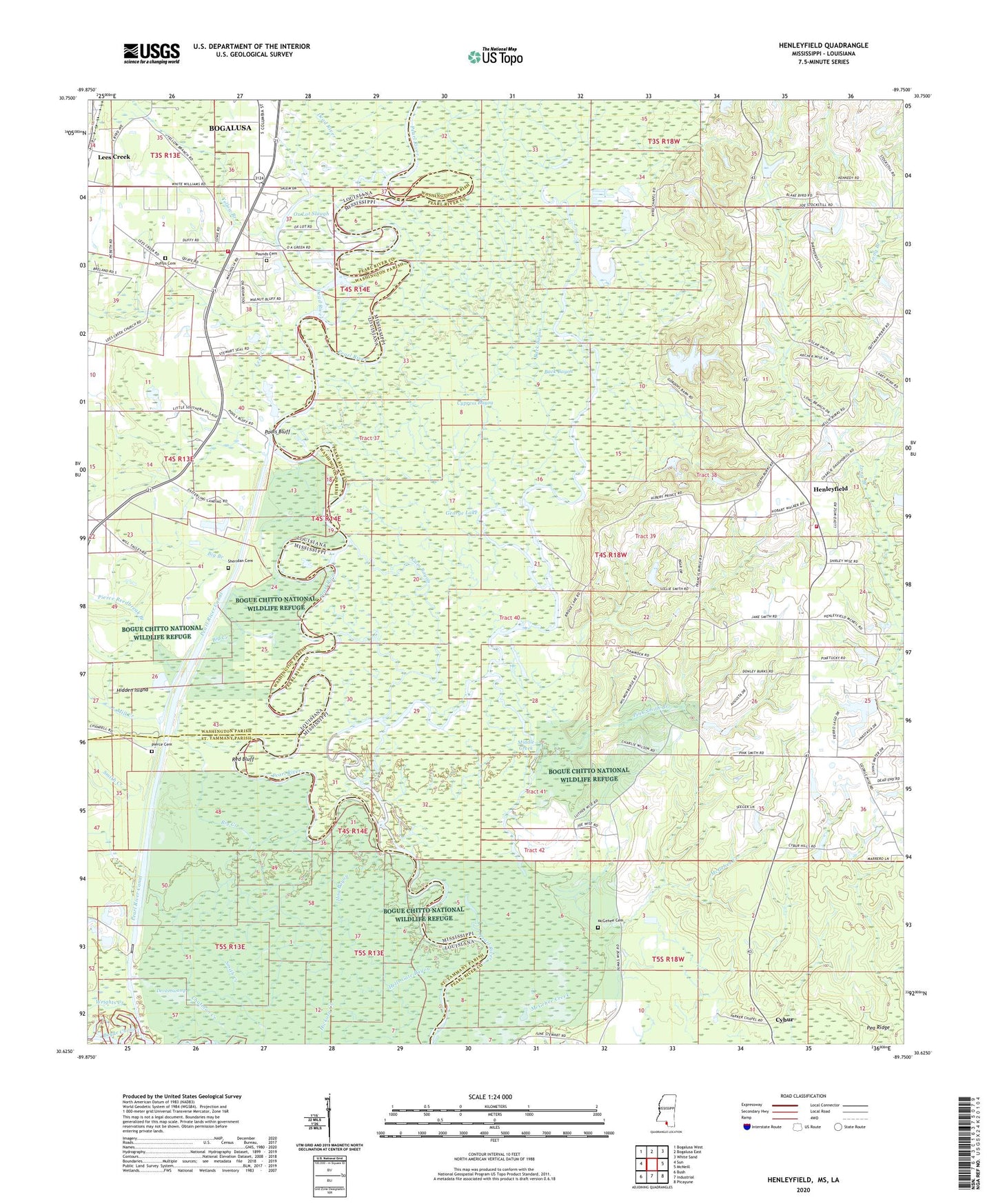
2024 topographic map quadrangle Henleyfield in the states of Mississippi, Louisiana. Scale: 1:24000. Based on the newly updated USGS 7.5' US Topo map series, this map is in the following counties: Pearl River, Washington, St. Tammany. The map contains contour data, water features, and other items you are used to seeing on USGS maps, but also has updated roads and other features. This is the next generation of topographic maps. Printed on high-quality waterproof paper with UV fade-resistant inks.
Quads adjacent to this one:
West: Sun
Northwest: Bogalusa West
North: Bogalusa East
Northeast: White Sand
East: McNeill
Southeast: Picayune
South: Industrial
Southwest: Bush
This map covers the same area as the classic USGS quad with code o30089f7.
Contains the following named places: Back Bayou, Big Branch, Byrds Chapel, Calvary Baptist Church, Chatman Creek, Chinquapin, Cybur, Cypress Bayou, Dead River, Devils Swamp, Duck Pond, Duffys Cemetery, East Jerusalem Church, First Baptist Church of Henleyfield, Fish Lake, George Lake, Gum Bayou, Henleyfield, Henleyfield School, Henleyfield Volunteer Fire Department, Hidden Island, Hog Bayou, Horseshoe Lake, Lees Creek, Lees Creek Church, Little Lake, Lock Number Three, Marias Branch, McGehee Cemetery, McGehee Creek, Middle Creek, Mill Creek, Moody Lake, Ox Lot Slough, Parker Chapel, Paul Weildy Lake Dam, Pearl River and Pearl River Canal Pool N, Pierce Cemetery, Pierce Reedbreak Branch, Pink Smith Branch, Pool Lake, Poole Bluff Sill and Pearl River Lock Three Dam, Pools Bluff, Pools Bluff Ferry, Pounds Cemetery, Red Bluff, Richardson Lake, Sheridan Cemetery, Sheridan Lake, Smith Creek, Socias Lake, Spears Lake, Ten Landing Lake, Washington Parish Addictive Disorders Clinic, Washington Parish Fire District 7 Station 6, Willa - Villa Mobile Home Park, Wise Lake, Wrights Creek, Yamacraw, Yellow Branch