MyTopo
Millard Mississippi US Topo Map
Couldn't load pickup availability
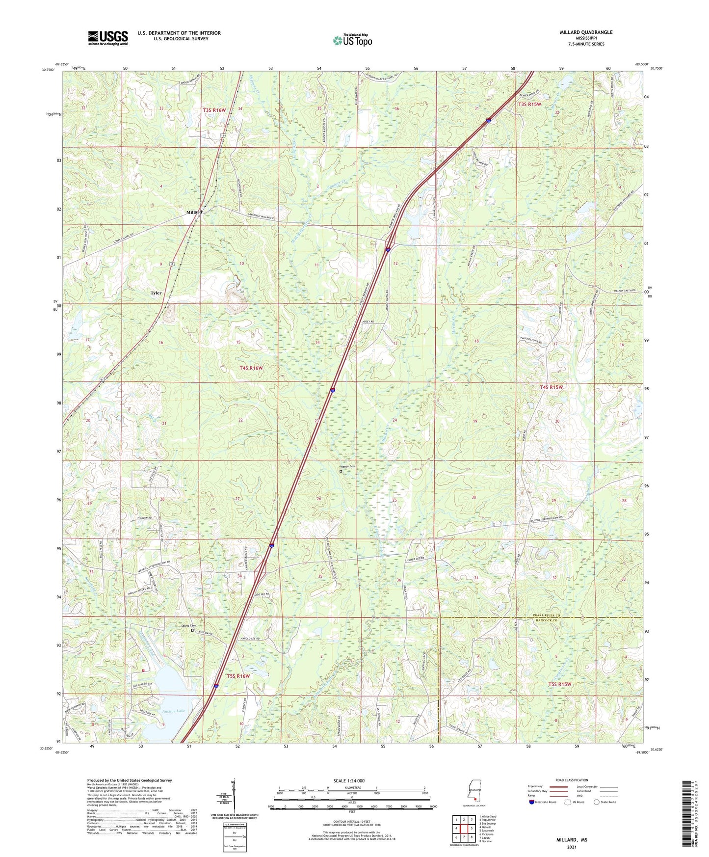
2024 topographic map quadrangle Millard in the state of Mississippi. Scale: 1:24000. Based on the newly updated USGS 7.5' US Topo map series, this map is in the following counties: Pearl River, Hancock. The map contains contour data, water features, and other items you are used to seeing on USGS maps, but also has updated roads and other features. This is the next generation of topographic maps. Printed on high-quality waterproof paper with UV fade-resistant inks.
Quads adjacent to this one:
West: McNeill
Northwest: White Sand
North: Poplarville
Northeast: Big Swamp
East: Savannah
Southeast: Necaise
South: Caesar
Southwest: Picayune
This map covers the same area as the classic USGS quad with code o30089f5.
Contains the following named places: Anchor Lake, Anchor Lake Dam, Carriere Volunteer Fire Department Station 4 Anchor Lake, Centre, Cypress Creek, Harts Chapel, Jumpoff Creek, Juniper Creek, Martin Cemetery, Millard, Moran Creek, Rolling Hills Baptist Chapel Church, Spiers Cemetery, Stecil Smith Lake Dam, Tyler