MyTopo
Acorn Ridge Missouri US Topo Map
Couldn't load pickup availability
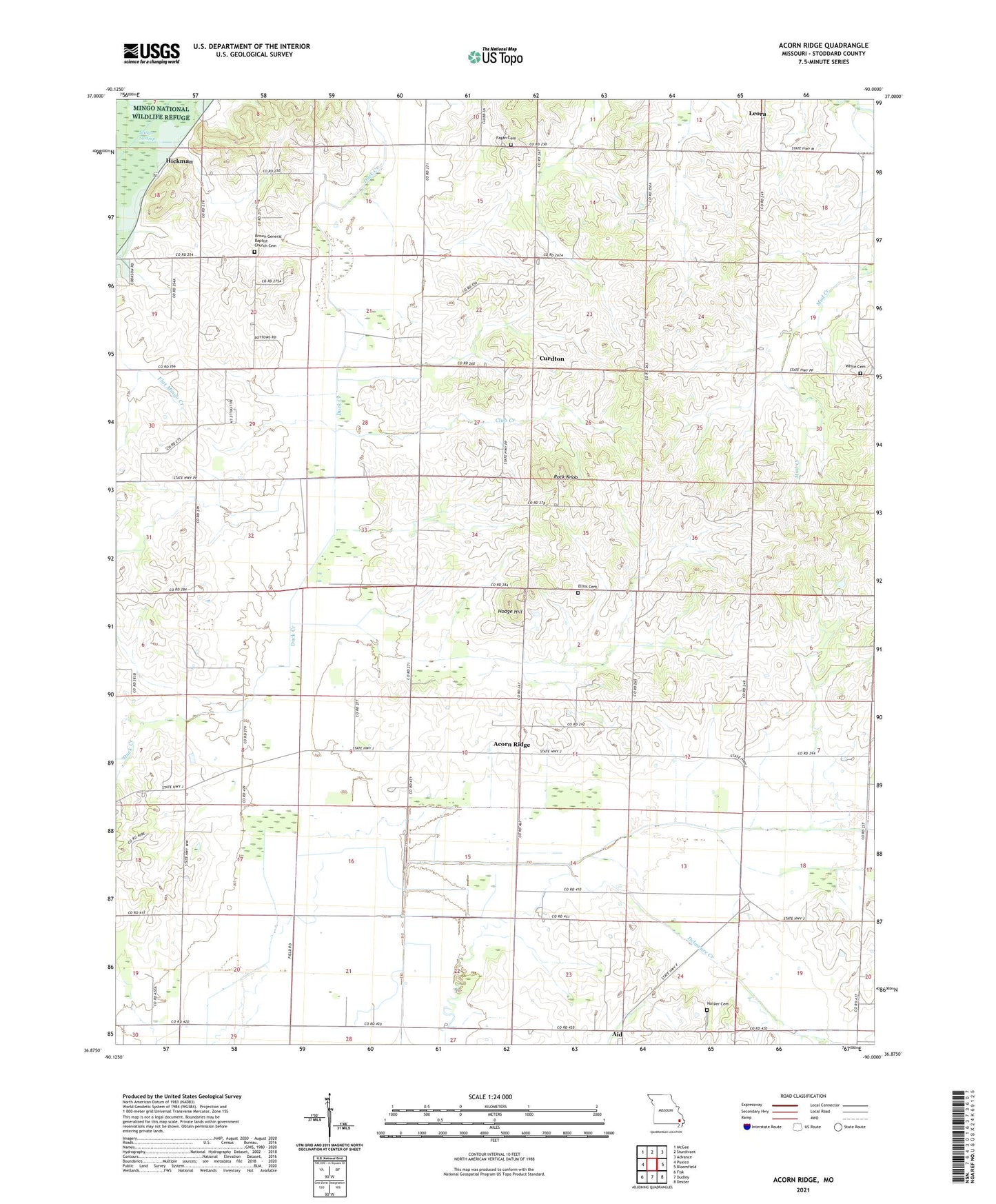
2021 topographic map quadrangle Acorn Ridge in the state of Missouri. Scale: 1:24000. Based on the newly updated USGS 7.5' US Topo map series, this map is in the following counties: Stoddard. The map contains contour data, water features, and other items you are used to seeing on USGS maps, but also has updated roads and other features. This is the next generation of topographic maps. Printed on high-quality waterproof paper with UV fade-resistant inks.
Quads adjacent to this one:
West: Puxico
Northwest: McGee
North: Sturdivant
Northeast: Advance
East: Bloomfield
Southeast: Dexter
South: Dudley
Southwest: Fisk
This map covers the same area as the classic USGS quad with code o36090h1.
Contains the following named places: Acorn Ridge, Aid, Alhambra, Brown Church, Castorville, Club Creek, Club School, Curdton, Delaware Creek, Elliot Cemetery, Fagan Cemetery, Fagan School, Fairview School, Goose Pond Ditch, Harper Cemetery, Hickman, Hodge Hill, Hollis Church, Liberty Hill Church, Lick Creek Ditch, Lick Creek School, Mount Olive Church, Mount Pleasant School, Rock Knob, Rockwell School, Skelton School, Township of New Lisbon, West Mount Pleasant Church, West Union Church, White Cemetery