MyTopo
Alanthus Grove Missouri US Topo Map
Couldn't load pickup availability
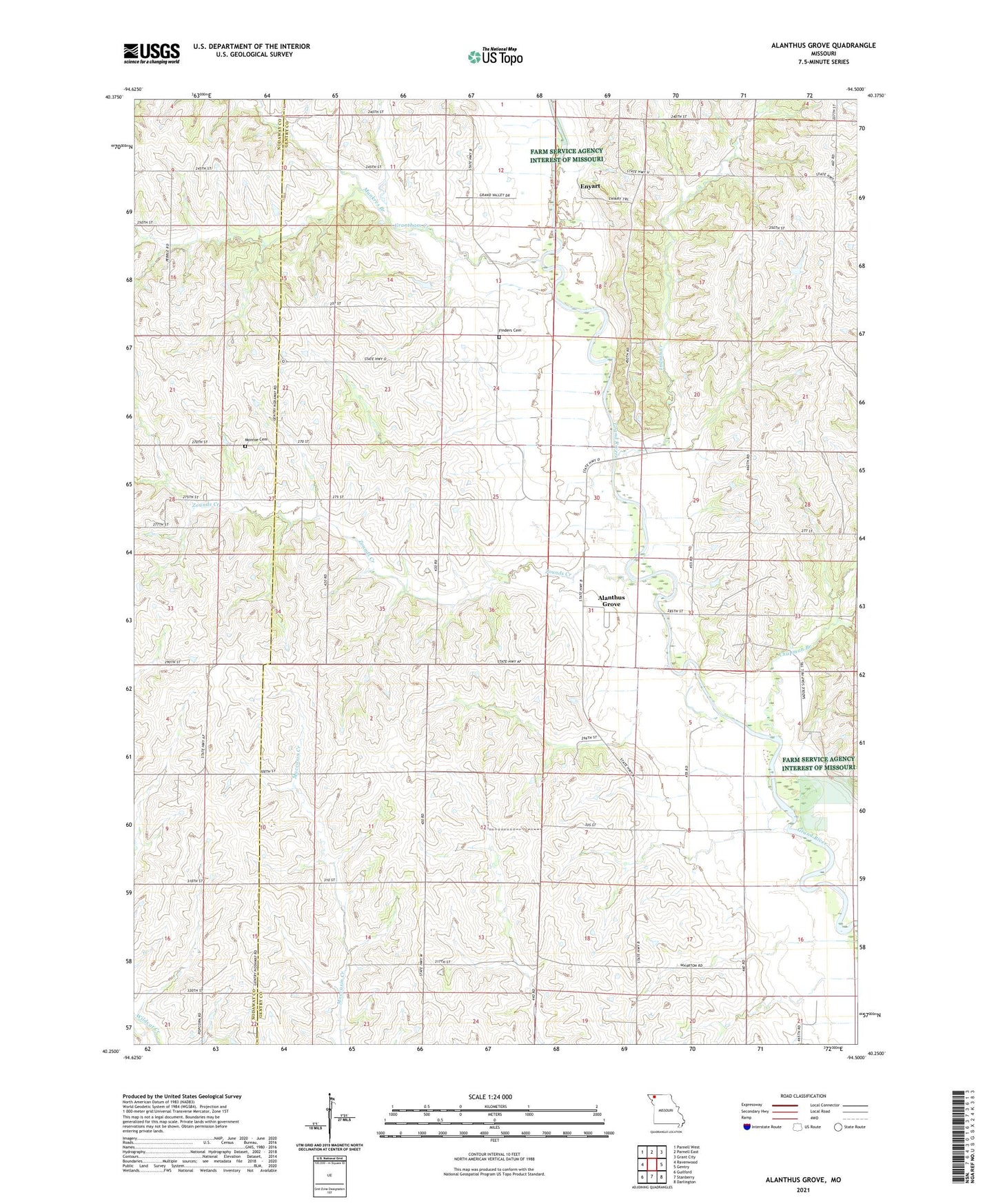
2021 topographic map quadrangle Alanthus Grove in the state of Missouri. Scale: 1:24000. Based on the newly updated USGS 7.5' US Topo map series, this map is in the following counties: Gentry, Nodaway. The map contains contour data, water features, and other items you are used to seeing on USGS maps, but also has updated roads and other features. This is the next generation of topographic maps. Printed on high-quality waterproof paper with UV fade-resistant inks.
Quads adjacent to this one:
West: Ravenwood
Northwest: Parnell West
North: Parnell East
Northeast: Grant City
East: Gentry
Southeast: Darlington
South: Stanberry
Southwest: Guilford
This map covers the same area as the classic USGS quad with code o40094c5.
Contains the following named places: Alanthus Grove, Alanthus School, Blackoak School, Chapman Branch, Enyart, Fairview School, Finders Cemetery, Grand River Church, Grantham Church, Grantham Creek, Grantham School, Indian Creek, Jennings School, LaBelle School, Liggett School, McClanahan School, Monroe Cemetery, Munkres Branch, Munkres School, Pleasant Hill Church, Township of Wilson, Wilson School, Zounds Creek