MyTopo
Gentry Missouri US Topo Map
Couldn't load pickup availability
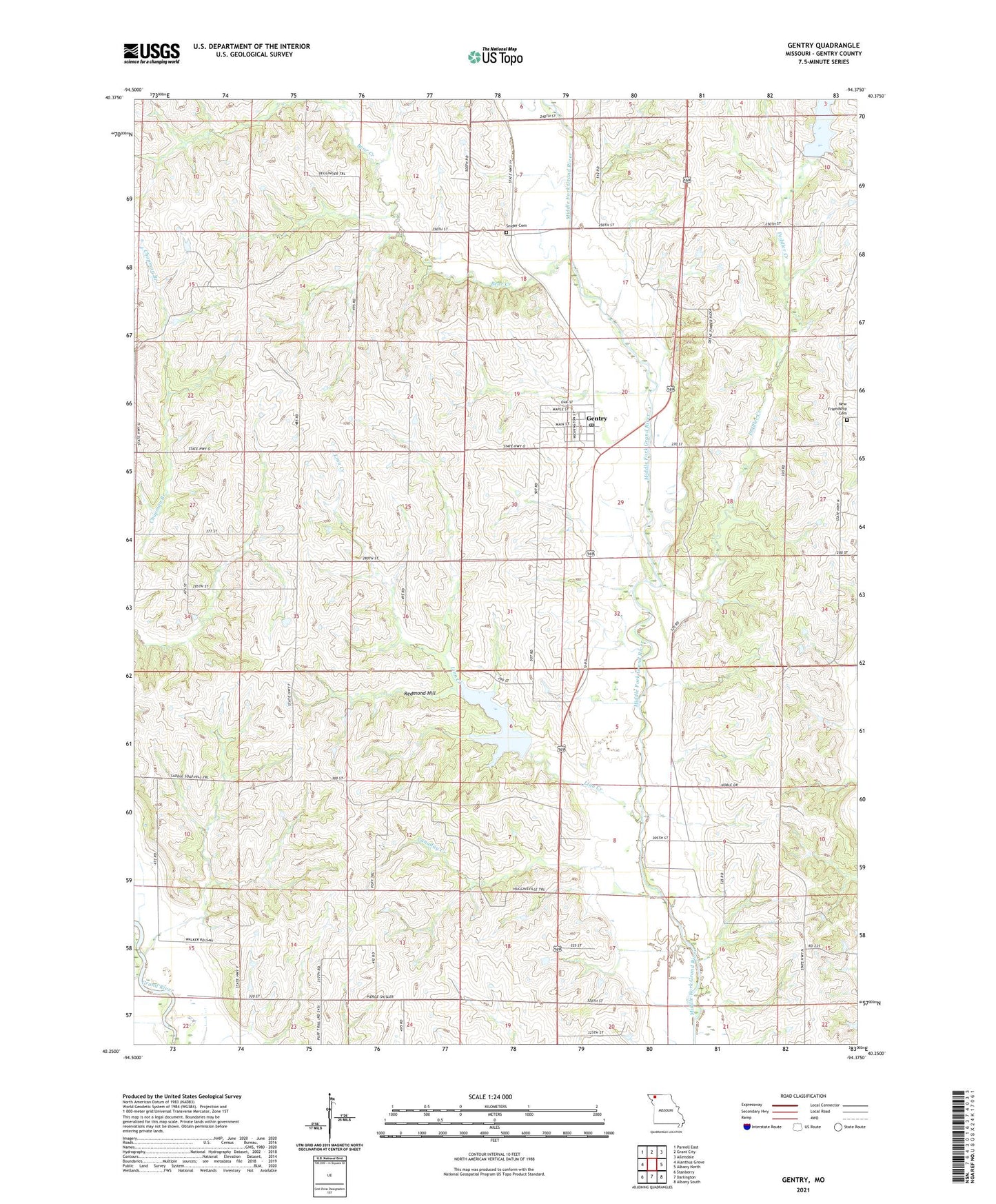
2021 topographic map quadrangle Gentry in the state of Missouri. Scale: 1:24000. Based on the newly updated USGS 7.5' US Topo map series, this map is in the following counties: Gentry. The map contains contour data, water features, and other items you are used to seeing on USGS maps, but also has updated roads and other features. This is the next generation of topographic maps. Printed on high-quality waterproof paper with UV fade-resistant inks.
Quads adjacent to this one:
West: Alanthus Grove
Northwest: Parnell East
North: Grant City
Northeast: Allendale
East: Albany North
Southeast: Albany South
South: Darlington
Southwest: Stanberry
This map covers the same area as the classic USGS quad with code o40094c4.
Contains the following named places: Bear Creek, Burnett School, Canaday Creek, Canaday School, Center Grove School, David School, Dure Lake Dam, Foster Lake Dam, Gentry, Gentry Post Office, Gillespie Lake Dam, Green Ridge Church, Hall School, Hugginsville School, Knox Church, Linn Creek, New Friendship Cemetery, New Friendship Church, Normal School, Peddler Creek, Redmond Hill, Shockley School, Smith Lake Dam, Snider Cemetery, Township of Bogle, Township of Huggins, Union School, Village of Gentry, Voyage, Waterman School, ZIP Code: 64453