MyTopo
Albany North Missouri US Topo Map
Couldn't load pickup availability
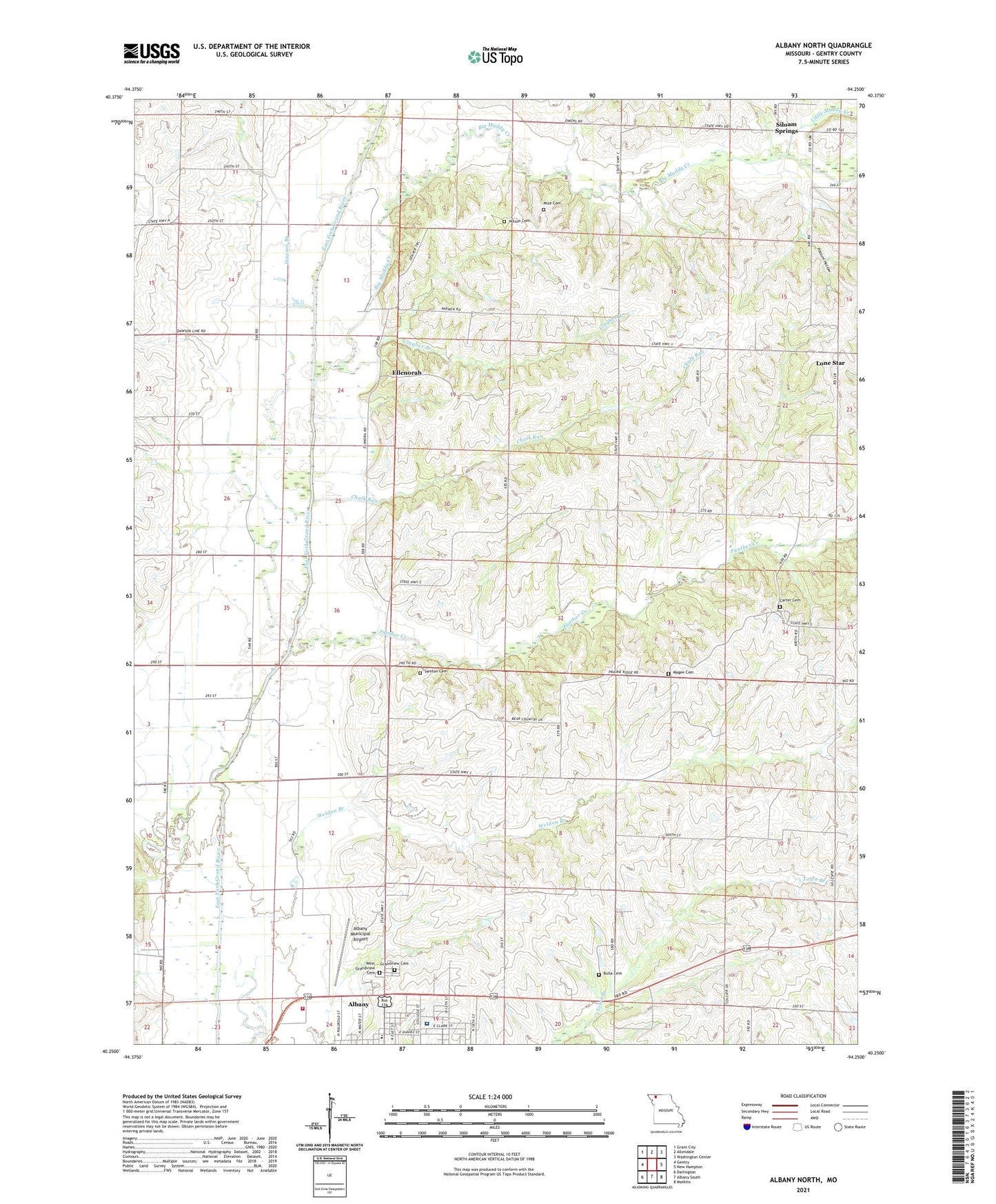
2021 topographic map quadrangle Albany North in the state of Missouri. Scale: 1:24000. Based on the newly updated USGS 7.5' US Topo map series, this map is in the following counties: Gentry. The map contains contour data, water features, and other items you are used to seeing on USGS maps, but also has updated roads and other features. This is the next generation of topographic maps. Printed on high-quality waterproof paper with UV fade-resistant inks.
Quads adjacent to this one:
West: Gentry
Northwest: Grant City
North: Allendale
Northeast: Washington Center
East: New Hampton
Southeast: Matkins
South: Albany South
Southwest: Darlington
Contains the following named places: Albany Community Fire Protection District, Albany High School, Albany Middle School, Albany Municipal Airport, Big Muddy Creek, Bulla Cemetery, Bulla School, Carter Cemetery, Chalk Run, Clayber Branch, Colvin School, Dawson Branch, Dawson School, Dorsey School, Ellenorah, Grandview Cemetery, Henton Cemetery, Hill Chapel, Little Muddy Creek, Lone Star, Lone Star School, Magee Cemetery, Missouri Department of Conservation Forestry Northwest Regional Field Fire Office Albany, Mize Cemetery, Needels School, Northwest Medical Center, Panther Creek, Pinhook, Pleasant Grove School, Pleasant Valley School, Possum Hollow, Siloam School, Siloam Springs, Township of Howard, Wayman School, Weldon Branch, West Grandview Cemetery, Wilson Cemetery, ZIP Code: 64402