MyTopo
Allendale Missouri US Topo Map
Couldn't load pickup availability
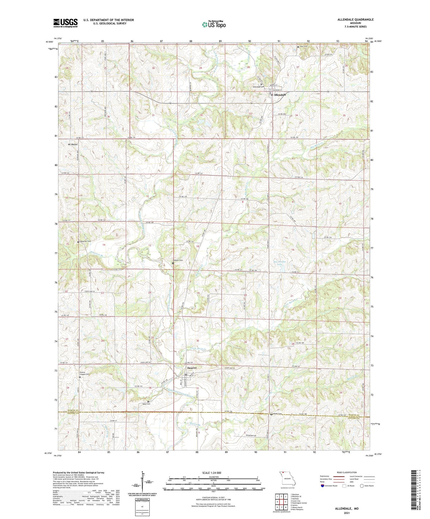
2021 topographic map quadrangle Allendale in the state of Missouri. Scale: 1:24000. Based on the newly updated USGS 7.5' US Topo map series, this map is in the following counties: Worth, Gentry. The map contains contour data, water features, and other items you are used to seeing on USGS maps, but also has updated roads and other features. This is the next generation of topographic maps. Printed on high-quality waterproof paper with UV fade-resistant inks.
Quads adjacent to this one:
West: Grant City
Northwest: Blockton
North: Blockton SE
Northeast: Hatfield
East: Washington Center
Southeast: New Hampton
South: Albany North
Southwest: Gentry
Contains the following named places: Allendale, Allendale Post Office, Amity School, Bea Dunfee Lake, Big Rock Creek, Brushy School, Denver, Denver Post Office, Dunfee Lake Dam, Eureka School, Findley Lake Dam, Freeland Church, Freeland School, Hoblett Cemetery, Hurst School, Jones East School, Kent Cemetery, Kirk Cemetery, Little Rock Creek, Lotts Creek, Martin Branch, Miller Cemetery, Miller School, Mount Waller, Neiger School, New Hope Church, Pine School, Prairie Chapel, Scott School, Township of Allen, Village of Allendale, Village of Denver, Wharton Branch, Wharton Cemetery, ZIP Codes: 64420, 64441