MyTopo
Williamsburg Missouri US Topo Map
Couldn't load pickup availability
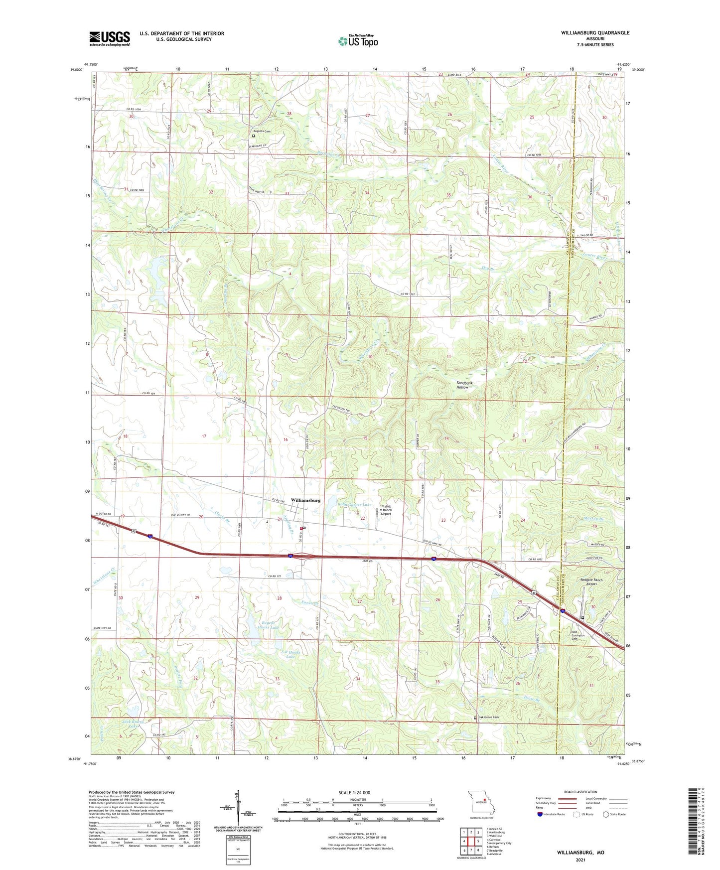
2021 topographic map quadrangle Williamsburg in the state of Missouri. Scale: 1:24000. Based on the newly updated USGS 7.5' US Topo map series, this map is in the following counties: Callaway, Montgomery. The map contains contour data, water features, and other items you are used to seeing on USGS maps, but also has updated roads and other features. This is the next generation of topographic maps. Printed on high-quality waterproof paper with UV fade-resistant inks.
Quads adjacent to this one:
West: Calwood
Northwest: Mexico SE
North: Martinsburg
Northeast: Wellsville
East: Montgomery City
Southeast: Americus
South: Readsville
Southwest: Reform
This map covers the same area as the classic USGS quad with code o38091h6.
Contains the following named places: American Central Corporation Lower Dam, American Central Corporation Upper Dam, Appling Branch, Augusta Cemetery, Augusta Church, Bachelor Creek, Dog Branch, E R Hooks Lake, Eckerts Airstrip, Elm Spring School, Eugene Hooks Lake, Flying V Ranch Airport, G and G Cattle Company East Dam, G and G Cattle Company West Dam, Gasper Dam, Heat String Creek, High Point Church, High Point School, Holt - Covington Cemetery, Jack Knittle Lake, John Gasper Lake, Johnson Chapel, Knittel Dam, Knittel Dam Number 2, Nine Mile Prairie, North Callaway Fire Protection District Station 2, Oak Grove Cemetery, Oak Grove Church, Pepmiller Lake Dam, Redgate Ranch Airport, Sandbank Hollow, Township of Nine Mile Prairie, Union School, Weeks School, Whetstone Creek State Wildlife Area, Whetstone Creek Wildlife Area Section 32 Dam, Whetstone Creek Wildlife Area Section 6 Lower Dam, Whetstone Creek Wildlife Area Section 6 Upper Dam, Whetstone Creek Wildlife Area Section 8 Dam, Williamsburg, Williamsburg Elementary School, Williamsburg Post Office