MyTopo
Appleton City Missouri US Topo Map
Couldn't load pickup availability
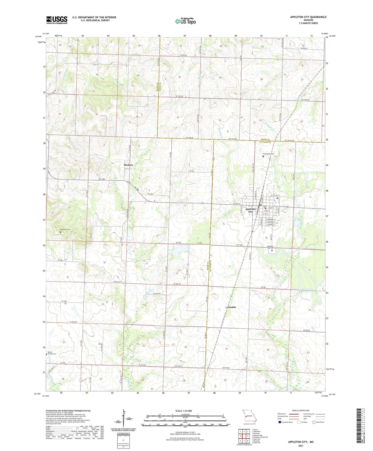
2021 topographic map quadrangle Appleton City in the state of Missouri. Scale: 1:24000. Based on the newly updated USGS 7.5' US Topo map series, this map is in the following counties: Bates, St. Clair, Henry. The map contains contour data, water features, and other items you are used to seeing on USGS maps, but also has updated roads and other features. This is the next generation of topographic maps. Printed on high-quality waterproof paper with UV fade-resistant inks.
Quads adjacent to this one:
West: Pleasant Gap
Northwest: Spruce
North: Johnstown
Northeast: Montrose
East: Monegaw Springs NW
Southeast: Taberville
South: Rockville
Southwest: Papinville
Contains the following named places: Appleton City, Appleton City Cemetery, Appleton City Elementary School, Appleton City Fire Department, Appleton City High School, Appleton City Lake, Appleton City Lake Dam, Appleton City Police Department, Appleton City Post Office, Blackwell Cemetery, Browning School, Brush College School, City of Appleton City, Ellett Memorial Hospital, Fennewald Cemetery, Hazel Dell School, Hudson, Hudson Elementary School, Hudson Post Office, Lindale, Marryfield School, McDavitt School, Mount Hope Community Center, Oak Grove School, Round Prairie Cemetery, Township of Hudson, ZIP Code: 64724