MyTopo
Rockville Missouri US Topo Map
Couldn't load pickup availability
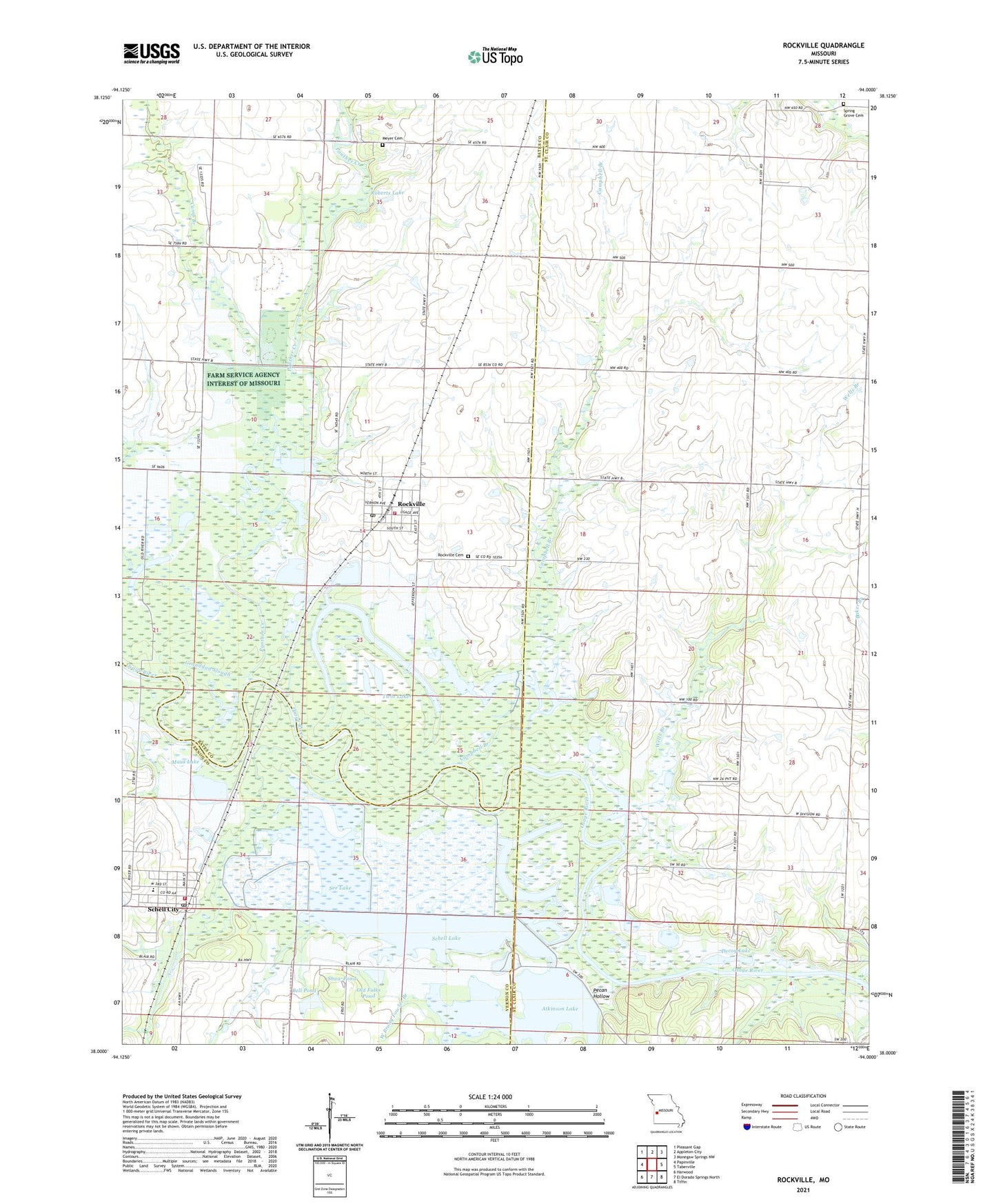
2021 topographic map quadrangle Rockville in the state of Missouri. Scale: 1:24000. Based on the newly updated USGS 7.5' US Topo map series, this map is in the following counties: St. Clair, Bates, Vernon. The map contains contour data, water features, and other items you are used to seeing on USGS maps, but also has updated roads and other features. This is the next generation of topographic maps. Printed on high-quality waterproof paper with UV fade-resistant inks.
Quads adjacent to this one:
West: Papinville
Northwest: Pleasant Gap
North: Appleton City
Northeast: Monegaw Springs NW
East: Taberville
Southeast: Tiffin
South: El Dorado Springs North
Southwest: Harwood
This map covers the same area as the classic USGS quad with code o38094a1.
Contains the following named places: Atkinson Lake, Atkinson Lake Dam, Barber Lake, Bell Pond, Camp Branch, Campbell Branch, City of Rockville, City of Schell City, Decoy Lake, Dewey School, Elm Grove School, Fowler Branch, Granddad Slough, Haines School, Heiman Field, Horseshoe Lake, Jones Lake, Levee Number Three Dam, Lost Branch, Maus Lake, Meyer Cemetery, Miller Branch, Mononame 47 Dam, Mononame 78 Dam, Northeast Vernon County R-1 Elementary School, Old Folks Pond, Osage School, Panther Creek, Pecan Hollow, Pleasant Grove Church, Prairie Hill School, Roberts Lake, Roberts Lake Dam, Rockville, Rockville Cemetery, Rockville Community Fire Department, Rockville Post Office, Rockville School, Schell City, Schell City Post Office, Schell City Volunteer Fire Department, Schell Lake, Schell-Osage Reservoir Number 2, Schell-Osage Wildlife Area, See Lake, Shaw Pond, Spring Grove Cemetery, Township of Rockville, Township of Taber, Twin Lakes, Wells Branch, West Prong Fowler Branch, ZIP Codes: 64780, 64783