MyTopo
Plattsburg Missouri US Topo Map
Couldn't load pickup availability
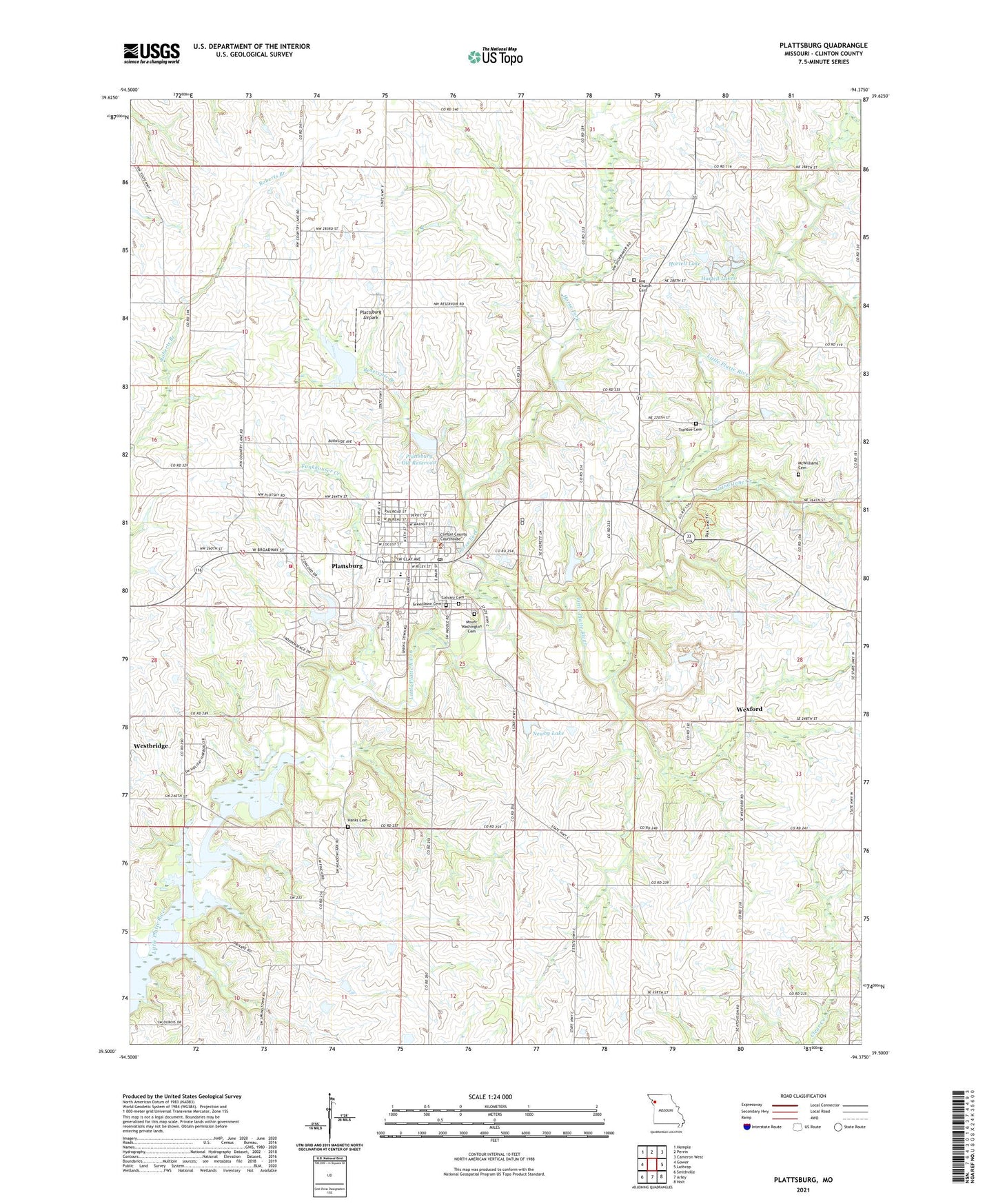
2021 topographic map quadrangle Plattsburg in the state of Missouri. Scale: 1:24000. Based on the newly updated USGS 7.5' US Topo map series, this map is in the following counties: Clinton. The map contains contour data, water features, and other items you are used to seeing on USGS maps, but also has updated roads and other features. This is the next generation of topographic maps. Printed on high-quality waterproof paper with UV fade-resistant inks.
Quads adjacent to this one:
West: Gower
Northwest: Hemple
North: Perrin
Northeast: Cameron West
East: Lathrop
Southeast: Holt
South: Arley
Southwest: Smithville
This map covers the same area as the classic USGS quad with code o39094e4.
Contains the following named places: Brethren Church, Calvary Cemetery, City of Plattsburg, Clark Airport, Clinton County, Clinton County Sheriff's Office, Duncan School, Ellis Elementary School, Everett Quarries Lake Dam, Forest Hill School, Funkhouser Creek, Greenlawn Cemetery, Grindstone Creek, Hanks Cemetery, Hartell Lake, Hartell Lakes, Hartell Lakes Dam, Hazel Dell School, Horse Fork, Jones School, Kimray Airport, Lake Concord Dam, Leg Church School, Log Church School, Lyon School, McWilliams Cemetery, Mount Washington Cemetery, Newby Lake, Newby Lake Dam, O'Connor Landing Strip, Perkins Park, Plattsburg, Plattsburg Airpark, Plattsburg Fire Protection District, Plattsburg High School, Plattsburg Middle School, Plattsburg Old Reservoir, Plattsburg Old Reservoir Dam, Plattsburg Post Office, Prairie Cottage School, Reservoir Branch, Six Mile Lane Lake, Six Mile Lane Lake Dam, Smithville Lake State Wildlife Area, Township of Concord, Transue Cemetery, Walnut Grove School, Wexford, ZIP Code: 64477