MyTopo
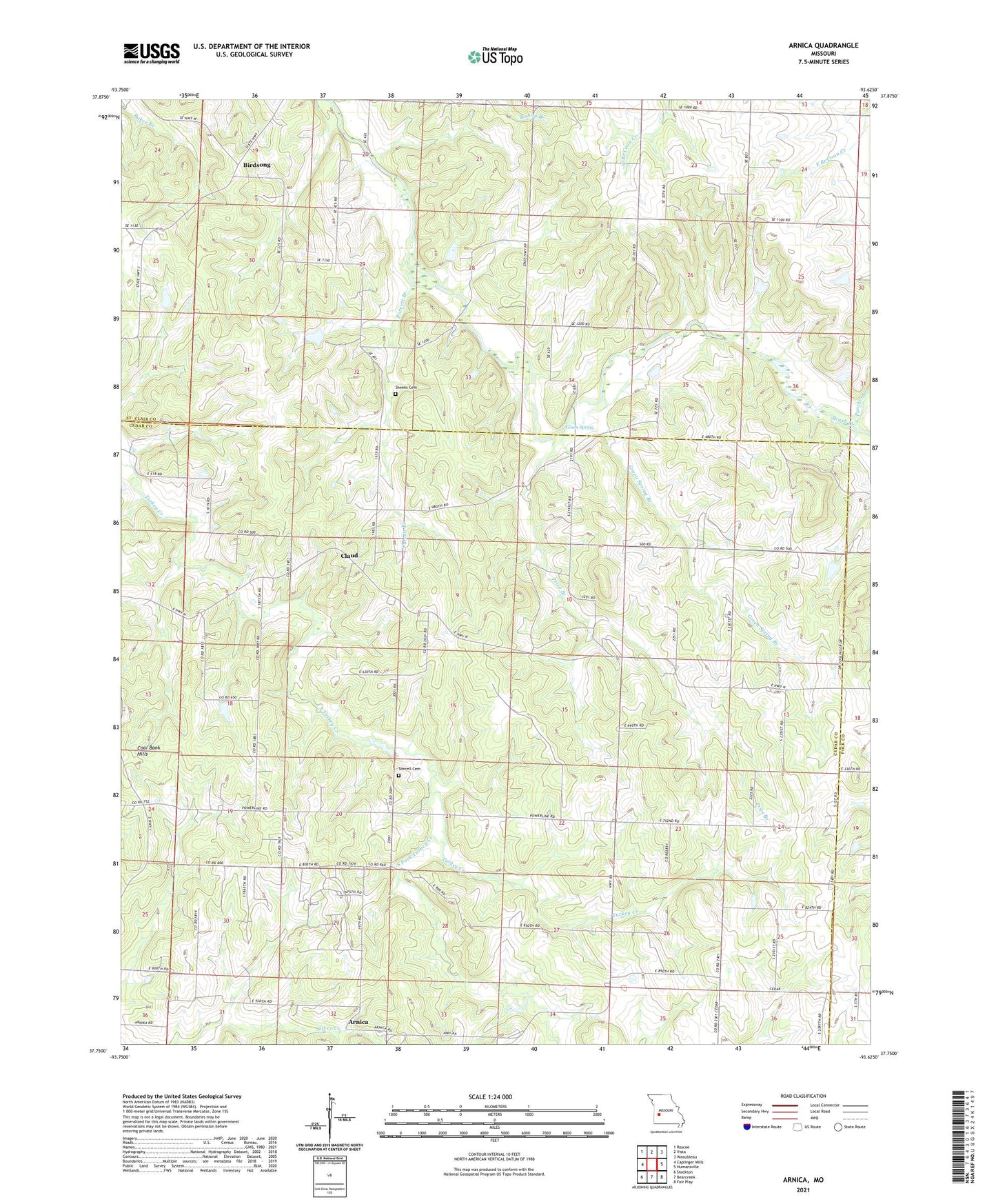
Arnica Missouri US Topo Map
Couldn't load pickup availability
2021 topographic map quadrangle Arnica in the state of Missouri. Scale: 1:24000. Based on the newly updated USGS 7.5' US Topo map series, this map is in the following counties: Cedar, St. Clair, Polk. The map contains contour data, water features, and other items you are used to seeing on USGS maps, but also has updated roads and other features. This is the next generation of topographic maps. Printed on high-quality waterproof paper with UV fade-resistant inks.
Quads adjacent to this one:
West: Caplinger Mills
Northwest: Roscoe
North: Vista
Northeast: Weaubleau
East: Humansville
Southeast: Fair Play
South: Bearcreek
Southwest: Stockton
Contains the following named places: Arnica, Arnica School, Birdsong, Birdsong State Wildlife Area, Brush Creek Church, Claud, Fairview Missionary Church, Fairview School, Green Spring, Green Spring Branch, Hamlet, Harvard School, Hickory Grove Church, Hickory Grove School, Liberty School, Mononame 532 Dam, Number 514 Dam, Panther Creek, Petermen Landing Strip, Prairie Mound School, Price Branch, Purcett Branch, Shady Hill School, Sheeks Cemetery, Simrell Cemetery, South Fork Turkey Creek, Township of Collins, Township of Washington, Veercamp School, Williams Store, Witt School