MyTopo
Mansfield Missouri US Topo Map
Couldn't load pickup availability
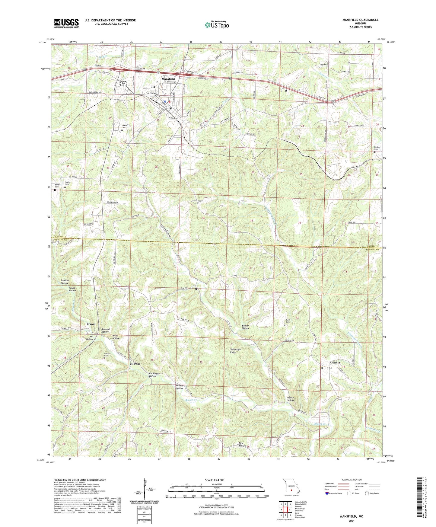
2021 topographic map quadrangle Mansfield in the state of Missouri. Scale: 1:24000. Based on the newly updated USGS 7.5' US Topo map series, this map is in the following counties: Douglas, Wright. The map contains contour data, water features, and other items you are used to seeing on USGS maps, but also has updated roads and other features. This is the next generation of topographic maps. Printed on high-quality waterproof paper with UV fade-resistant inks.
Quads adjacent to this one:
West: Cedar Gap
Northwest: Mansfield NW
North: Mansfield NE
Northeast: Owens
East: Norwood
Southeast: Brushyknob
South: Sweden
Southwest: Ava
This map covers the same area as the classic USGS quad with code o37092a5.
Contains the following named places: Ashley Church, Baker Cemetery, Bouser Hollow, Bryant, Buzzard Hollow, City of Mansfield, Crain Cemetery, Deaker Cemetery, Department of Conservation Ozark Field Fire Office Mansfield, Dyer Cemetery, Endeavor School, Fairview Church, Findley Cemetery, Flat Rock School, Hicks Hollow, Hicks School, Highway Church, Huffman School, Keith Cemetery, KTRI-FM (Mansfield), Laura Ingalls Wilder House, Mansfield, Mansfield Fire Department, Mansfield Police Department, Mansfield Post Office, Midway, Mill Hollow, Mount Everett Church, Mount Pleasant Church, Oak Grove School, Olathia, Prairie Hollow, Privet Hollow, Puncheon Camp Creek, Rockhouse Hollow, Rockhouse School, Roy School, Shiloh Church, Shiloh School, Shinpaugh Ridge, Smelter Hollow, South Fork Dry Creek, Spence School, Township of Miller, Township of Pleasant Valley, Wallace Cemetery, Winkle Hollow, Wolf Creek Church