MyTopo
Banner Missouri US Topo Map
Couldn't load pickup availability
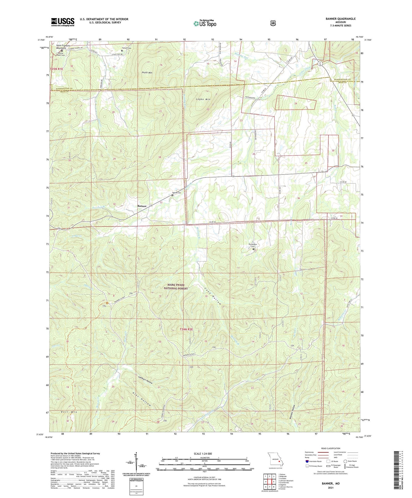
2021 topographic map quadrangle Banner in the state of Missouri. Scale: 1:24000. Based on the newly updated USGS 7.5' US Topo map series, this map is in the following counties: Iron, Washington. The map contains contour data, water features, and other items you are used to seeing on USGS maps, but also has updated roads and other features. This is the next generation of topographic maps. Printed on high-quality waterproof paper with UV fade-resistant inks.
Quads adjacent to this one:
West: Johnson Mountain
Northwest: Palmer
North: Belgrade
Northeast: Irondale
East: Graniteville
Southeast: Ironton
South: Johnson Shut-Ins
Southwest: Edgehill
Contains the following named places: Alec Hollow, Banner, Bell Mountain, Bell Mountain Lookout Tower, Bell Mountain Wilderness, Belleview Valley Nursing Home, Cedar Grove Church, Cedar Grove School, Coon Hollow, Full Gospel Chapel, Hansop School, Keesling Branch, Lambert Hollow, Logan Mountain, McClurg Branch, Nelson Cemetery, Pruitt Mountain, Reid Creek, Richardson Cemetery, Ried Creek School, Ruddick School, Rutledge Run, Saline Creek, Thomas Chapel, Thomas Chapel Cemetery, Trailhead Parking Area, Tullock Cemetery