MyTopo
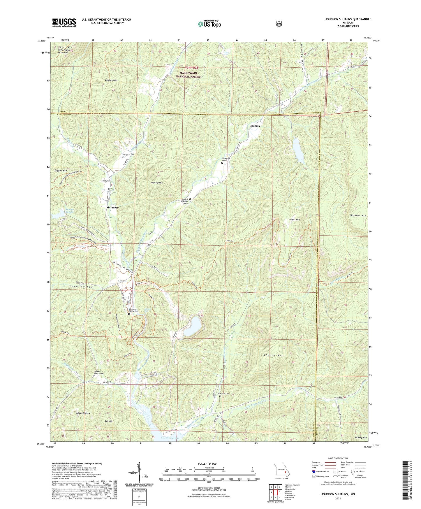
Johnson Shut-Ins Missouri US Topo Map
Couldn't load pickup availability
Also explore the Johnson Shut-Ins Forest Service Topo of this same quad for updated USFS data
2021 topographic map quadrangle Johnson Shut-Ins in the state of Missouri. Scale: 1:24000. Based on the newly updated USGS 7.5' US Topo map series, this map is in the following counties: Reynolds, Iron. The map contains contour data, water features, and other items you are used to seeing on USGS maps, but also has updated roads and other features. This is the next generation of topographic maps. Printed on high-quality waterproof paper with UV fade-resistant inks.
Quads adjacent to this one:
West: Edgehill
Northwest: Johnson Mountain
North: Banner
Northeast: Graniteville
East: Ironton
Southeast: Glover
South: Lesterville
Southwest: Centerville
This map covers the same area as the classic USGS quad with code o37090e7.
Contains the following named places: Chapman Cemetery, Church Mountain, Cope Hollow, Fitzgerald Cemetery, Hasty Cemetery, High Top Mountain, Imboden Fork, Johnson Shut-Ins, Johnson's Shut-Ins State Park, Lee Mountain, Lindsey Mountain, Little Taum Sauk Creek, Lower Imboden School, Lower Reservoir, Marys Chapel, Middlebrook Development Lake Dam, Monterey, Munger, Munger School, New Hope Church, Number 49 Lake, Perdido Dam, Pinkley, Pinkleys School, Proffit Mountain, Sawyer School, Shut-in Creek, Taum Sauk Cemetery, Taum Sauk Creek, Taum Sauk Nature Museum, Taum Sauk Pumped-Storage Hydroelectric Powerplant, Taum Sauk Upper Dam, Upper Imboden School, Upper Reservoir, Walker Branch, Walker Branch Church, Walker Branch School, Wildcat Mountain, Womble Hollow, ZIP Code: 63656