MyTopo
Belews Creek Missouri US Topo Map
Couldn't load pickup availability
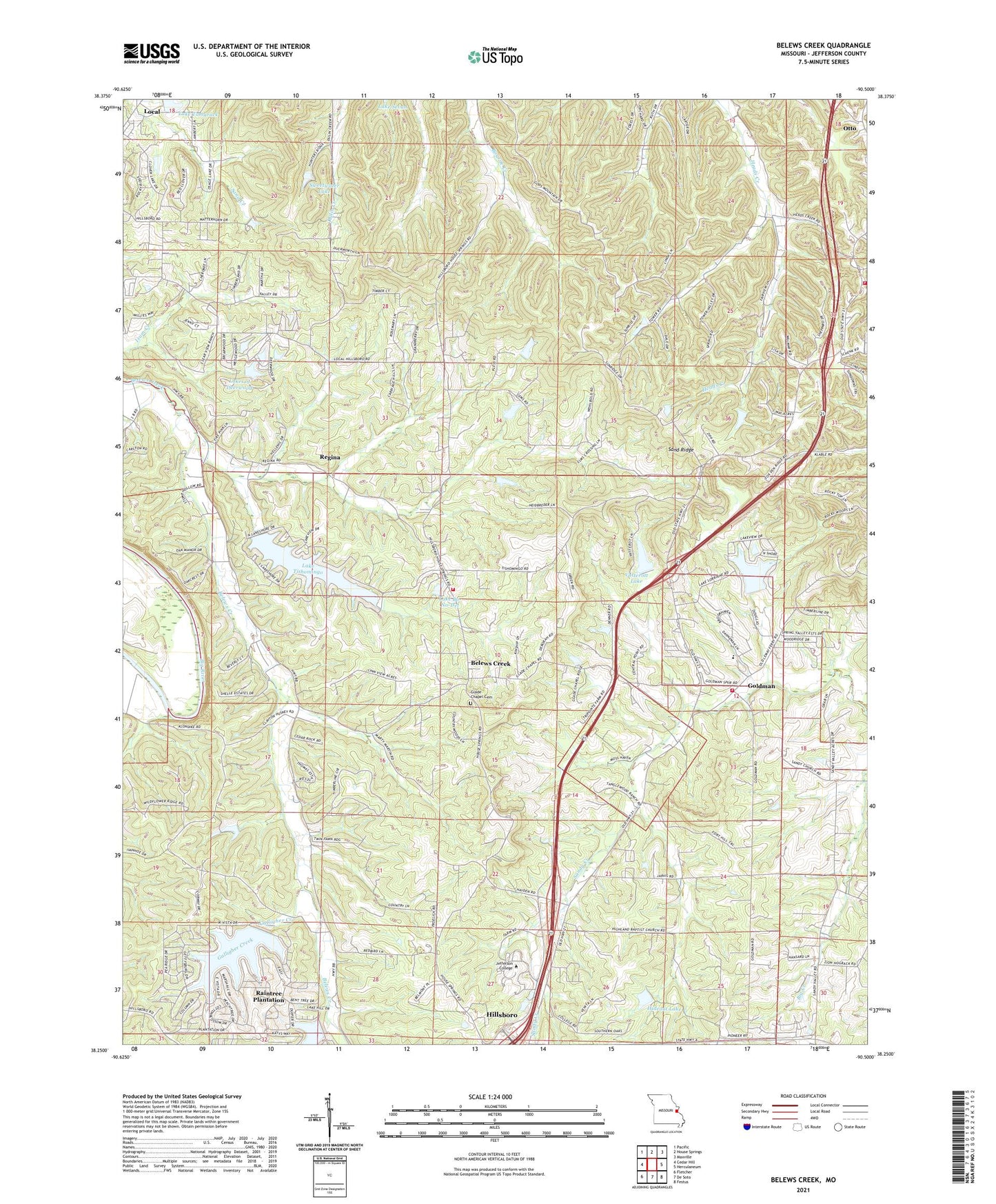
2021 topographic map quadrangle Belews Creek in the state of Missouri. Scale: 1:24000. Based on the newly updated USGS 7.5' US Topo map series, this map is in the following counties: Jefferson. The map contains contour data, water features, and other items you are used to seeing on USGS maps, but also has updated roads and other features. This is the next generation of topographic maps. Printed on high-quality waterproof paper with UV fade-resistant inks.
Quads adjacent to this one:
West: Cedar Hill
Northwest: Pacific
North: House Springs
Northeast: Maxville
East: Herculaneum
Southeast: Festus
South: De Soto
Southwest: Fletcher
Contains the following named places: Antonia Fire Protection District Station 3, Autumn Lake, Baker School, Becker Lake, Becker Lake Dam, Belews Creek, Bequette Dam, Boyher Lake Dam, Central School, Cole Lake, Cole Lake Dam, Daley Lake Dam, Deerwood Lake Number 3 Dam, Dehner Lake Dam, Galligher Creek, Glade Chapel, Glen Leonard Dam, Glen Leonard Lake, Goldman, Goldman Fire Protection District Station 1 Headquarters, Goldman Fire Protection District Station 2, Granada Meadows, Gwenmil Lake Dam, Hideout Lake, Hideout Lake Dam, Highland Church, Highland School, Huskey School, Jefferson College, Jefferson County, KNLC-TV (St Louis), La Ferla Lake Dam, Lake Bo-No-Del, Lake Bo-No-Del Dam, Lake Loraine, Lake Lorraine Dam, Lake Tamarack, Lake Tishomingo, Lake Tishomingo Dam, Lakes of Deerwood, Lakes of Deerwood Number One Dam, Lakes of Deerwood Number Two Dam, Lindwell Lake Dam, Local, Mount Olive School, Oak Hill School, Otto, Raintree Plantation, Raintree Plantation Census Designated Place, Regina, Reichmuth Lake Dam, Sand Ridge, Stephens Church, Sweetwater Dam, Sweetwater Lake, Vatterott Lake, Vatterott Lake Dam, Wagner Lake Dam, ZIP Code: 63050