MyTopo
Jonesburg Missouri US Topo Map
Couldn't load pickup availability
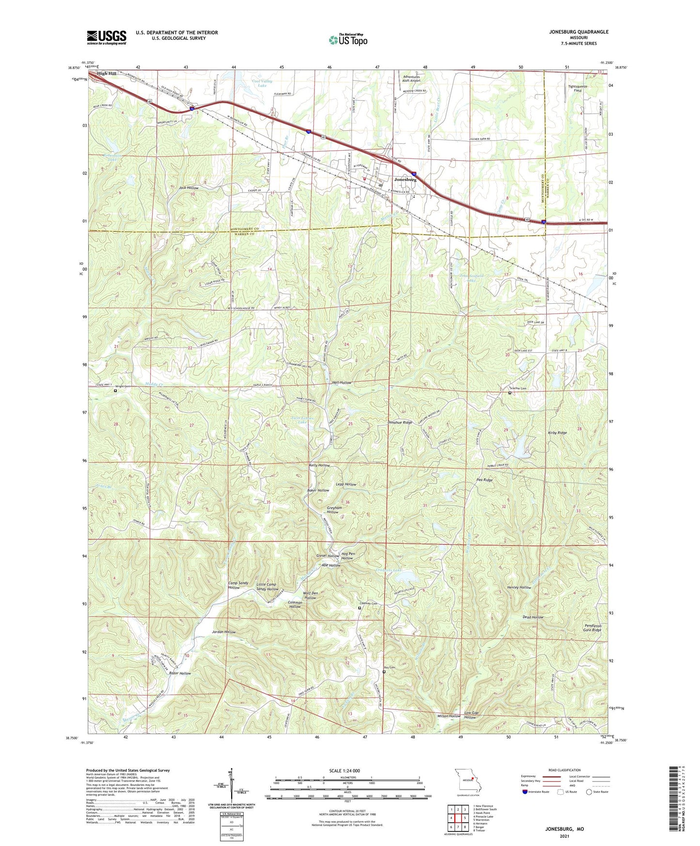
2021 topographic map quadrangle Jonesburg in the state of Missouri. Scale: 1:24000. Based on the newly updated USGS 7.5' US Topo map series, this map is in the following counties: Warren, Montgomery. The map contains contour data, water features, and other items you are used to seeing on USGS maps, but also has updated roads and other features. This is the next generation of topographic maps. Printed on high-quality waterproof paper with UV fade-resistant inks.
Quads adjacent to this one:
West: Pinnacle Lake
Northwest: New Florence
North: Bellflower South
Northeast: Hawk Point
East: Warrenton
Southeast: Treloar
South: Berger
Southwest: Hermann
This map covers the same area as the classic USGS quad with code o38091g3.
Contains the following named places: Abe Hollow, Adventures Aloft Airport, Baker Hollow, Ball School, Big Four School, Bullar Lake Dam, Camp Sandy Creek, Camp Sandy Hollow, Casper Lake Dam, Central School, City of Jonesburg, Coleman Cemetery, Coleman Hollow, Cool Valley Lake, Crancers Lake, Crancers Lake Dam, Crancers Lake Section 7 South Dam, Dead Hollow, Donahue Ridge, Giesel Hollow, Greyham Hollow, Hall Hollow, Hambauch Lake Dam, Henley Hollow, Hicks Lake Section 20 North Dam, Hicks Lake Section 20 South Dam, Hog Pen Hollow, Jack Hollow, John Scofield Lake, Jonesburg, Jonesburg - High Hill Fire Protection District, Jonesburg Elementary School, Jonesburg Post Office, Jordan Hollow, Kelly Hollow, Kelly Lake Dam, Kirby Ridge, Lepp Hollow, Little Camp Sandy Hollow, Little Lost Creek State Forest, Longstreet Lake Dam, Low Gap Hollow, Martin School, Muddy Creek, Oak Grove Church, Oak Grove School, Pea Ridge, Progressive School, Ray Cemetery, Razor Hollow, Robertson Lake, Scachse Cemetery, Scofield Lake Number 3 Dam, Tightsqueeze Field, Township of Bridgeport, Twin Echoes Lake, Watkins Branch, Wilson Hollow, Wolf Den Hollow, Wright Cemetery, ZIP Code: 63351