MyTopo
Beulah Missouri US Topo Map
Couldn't load pickup availability
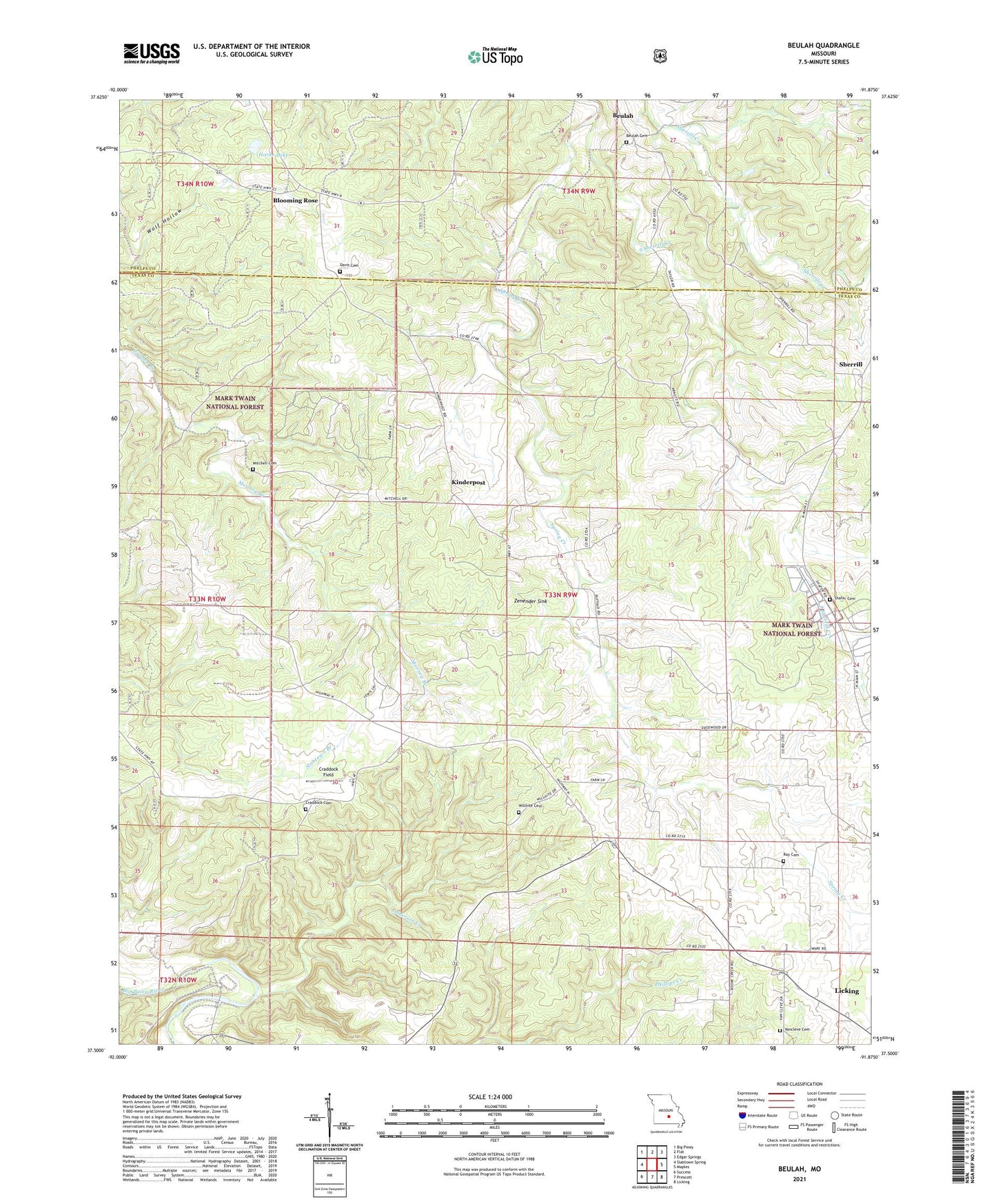
2021 topographic map quadrangle Beulah in the state of Missouri. Scale: 1:24000. Based on the newly updated USGS 7.5' US Topo map series, this map is in the following counties: Texas, Phelps. The map contains contour data, water features, and other items you are used to seeing on USGS maps, but also has updated roads and other features. This is the next generation of topographic maps. Printed on high-quality waterproof paper with UV fade-resistant inks.
Quads adjacent to this one:
West: Slabtown Spring
Northwest: Big Piney
North: Flat
Northeast: Edgar Springs
East: Maples
Southeast: Licking
South: Prescott
Southwest: Success
Contains the following named places: Anderson Creek, Bethlehem School, Beulah, Beulah Cemetery, Blooming Rose, Blooming Rose School, Craddock Cemetery, Craddock Field, Craddock School, Davis Cemetery, Dent, Harke Lake, Harke Lake Dam, Kinderpost, Licking State Forest Nursery, Mason Bridge River Access and Boat Launch, Mitchell Cemetery, Ray Cemetery, Shafer Cemetery, Sherrill, Sherrill School, South Sherrill Creek, Texas Lookout Tower, Vancleve Cemetery, Walnut Ridge School, Willhite Cemetery, Zenender Sink, ZIP Code: 65436