MyTopo
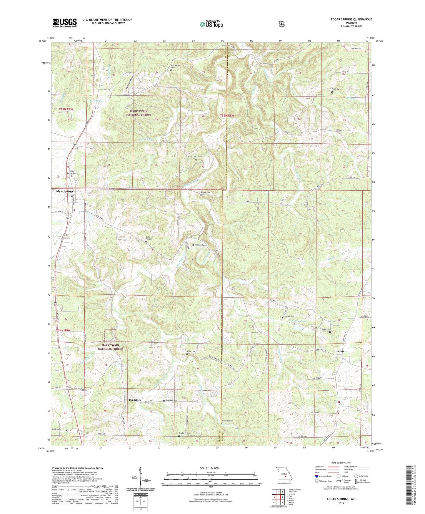
Edgar Springs Missouri US Topo Map
Couldn't load pickup availability
Also explore the Edgar Springs Forest Service Topo of this same quad for updated USFS data
2021 topographic map quadrangle Edgar Springs in the state of Missouri. Scale: 1:24000. Based on the newly updated USGS 7.5' US Topo map series, this map is in the following counties: Dent, Phelps. The map contains contour data, water features, and other items you are used to seeing on USGS maps, but also has updated roads and other features. This is the next generation of topographic maps. Printed on high-quality waterproof paper with UV fade-resistant inks.
Quads adjacent to this one:
West: Flat
Northwest: Kaintuck Hollow
North: Yancy Mills
Northeast: Lecoma
East: Anutt
Southeast: Rhyse
South: Maples
Southwest: Beulah
This map covers the same area as the classic USGS quad with code o37091f7.
Contains the following named places: Antioch School, Bassinger Union Memorial Chapel, Bean Creek, Black Cemetery, Black Oak Creek, Black Oak School, Cedar Hill Cemetery, Cedar Hill Church, Church of Christ, City of Edgar Springs, Craddock, Craddock Cemetery, Edgar Spring, Edgar Springs, Edgar Springs Cemetery, Edgar Springs Post Office, Edgar Springs Rural Fire Department, Enke Cemetery, Enon Church, Evening Shade Church, Evening Shade School, Everywhere Branch, First Baptist Church, Freemans Store, Hall/Heavin Cemetery, Horse Creek, Jackson Branch, Jocoy Cemetery, Kitchen Cemetery, Lake Tealwood, Lenox, Lenox Rural Fire Department Headquarters, Mitchell Cemetery, Mount Tabor School, North Lenox, Old Edgar Springs Cemetery, Renaud Cemetery, Richard F Clement Memorial State Forest and Wildlife Area, Roseberry Cemetery, Sample Creek, Samples Cemetery, Tealwood Dam, Weber Cemetery, Weber School, ZIP Codes: 65462, 65541