MyTopo
Flat Missouri US Topo Map
Couldn't load pickup availability
Also explore the Flat Forest Service Topo of this same quad for updated USFS data
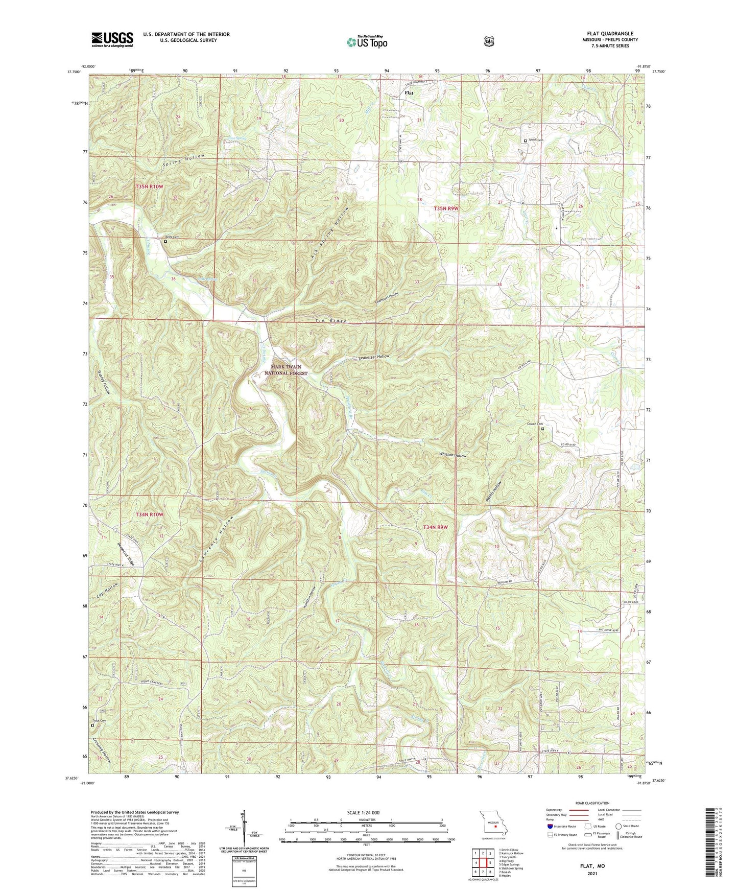
2021 topographic map quadrangle Flat in the state of Missouri. Scale: 1:24000. Based on the newly updated USGS 7.5' US Topo map series, this map is in the following counties: Phelps. The map contains contour data, water features, and other items you are used to seeing on USGS maps, but also has updated roads and other features. This is the next generation of topographic maps. Printed on high-quality waterproof paper with UV fade-resistant inks.
Quads adjacent to this one:
West: Big Piney
Northwest: Devils Elbow
North: Kaintuck Hollow
Northeast: Yancy Mills
East: Edgar Springs
Southeast: Maples
South: Beulah
Southwest: Slabtown Spring
This map covers the same area as the classic USGS quad with code o37091f8.
Contains the following named places: Ash Spring Hollow, Bethel Church, Beulah Baptist Church, Blooming Rose CCC Camp, Bradford Branch, Cave Spring, Chambers Hollow, Cowan Cemetery, Edgar Springs School, Elm Creek, Elm Spring School, Flat, Hamilton Hollow, Lady of Perpetual Help Church, Lawrence Hollow, Ledbetter Hollow, Mathis Hollow, Mathis School, Rambo Church, Rambo School, Relfe, Relfe Cemetery, Relfe School, Relfe Spring, Sherrill Creek, Smith Cemetery, Smith Church, Teasley Hollow, Tie Ridge, Township of Spring Creek, Trout Cemetery, West Point School, Whitson Hollow