MyTopo
Billmore Missouri US Topo Map
Couldn't load pickup availability
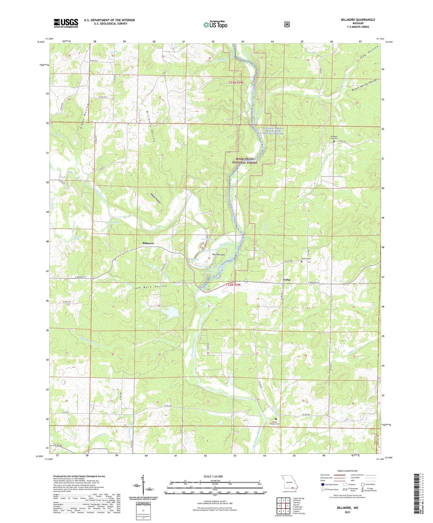
2021 topographic map quadrangle Billmore in the state of Missouri. Scale: 1:24000. Based on the newly updated USGS 7.5' US Topo map series, this map is in the following counties: Oregon, Ripley. The map contains contour data, water features, and other items you are used to seeing on USGS maps, but also has updated roads and other features. This is the next generation of topographic maps. Printed on high-quality waterproof paper with UV fade-resistant inks.
Quads adjacent to this one:
West: Myrtle
Northwest: Many Springs
North: Riverton
Northeast: Bardley
East: Gatewood
Southeast: Warm Springs
South: Dalton
Southwest: Hardy NE
Contains the following named places: Baker School, Big Branch, Billmore, Billmore Hollow, Billmore School, Blue Spring, Brown Spring Hollow, Caldwell Spring, Calm, Colvin Creek, Cotton Creek, Dog Hollow, Dry Creek, Dry Creek School, Fagan Creek, Fairview School, Frederick Creek, Gatewood Volunteer Fire Department Station 4, Griswold, Griswold Post Office, Happy Hollow, Hurricane Creek, Johnson Ferry, Jones Spring, Kimes Hollow, Liberty Church, Liberty School, Little Branch, Lum Barn Hollow, Morgan Spring, Mount Carmel Cemetery, Mount Carmel Church, Mount Carmel School, Mud Spring, Myrtle Church, Peace Valley School, Piney Creek, Pleasant Hill Cemetery, Pleasant Hill School, Rush Creek, Rush Creek Camp, Sand Spring, Sibkey Spring, Spring Valley Creek, Stubblefield Branch, Stubblefield Ferry, Sullivan Spring, Swamp Creek, The Narrows, The Narrows Access, Thomasons Mill, Township of Billmore, Township of Cedar Bluff, Vault Spring, Water, Water Post Office