MyTopo
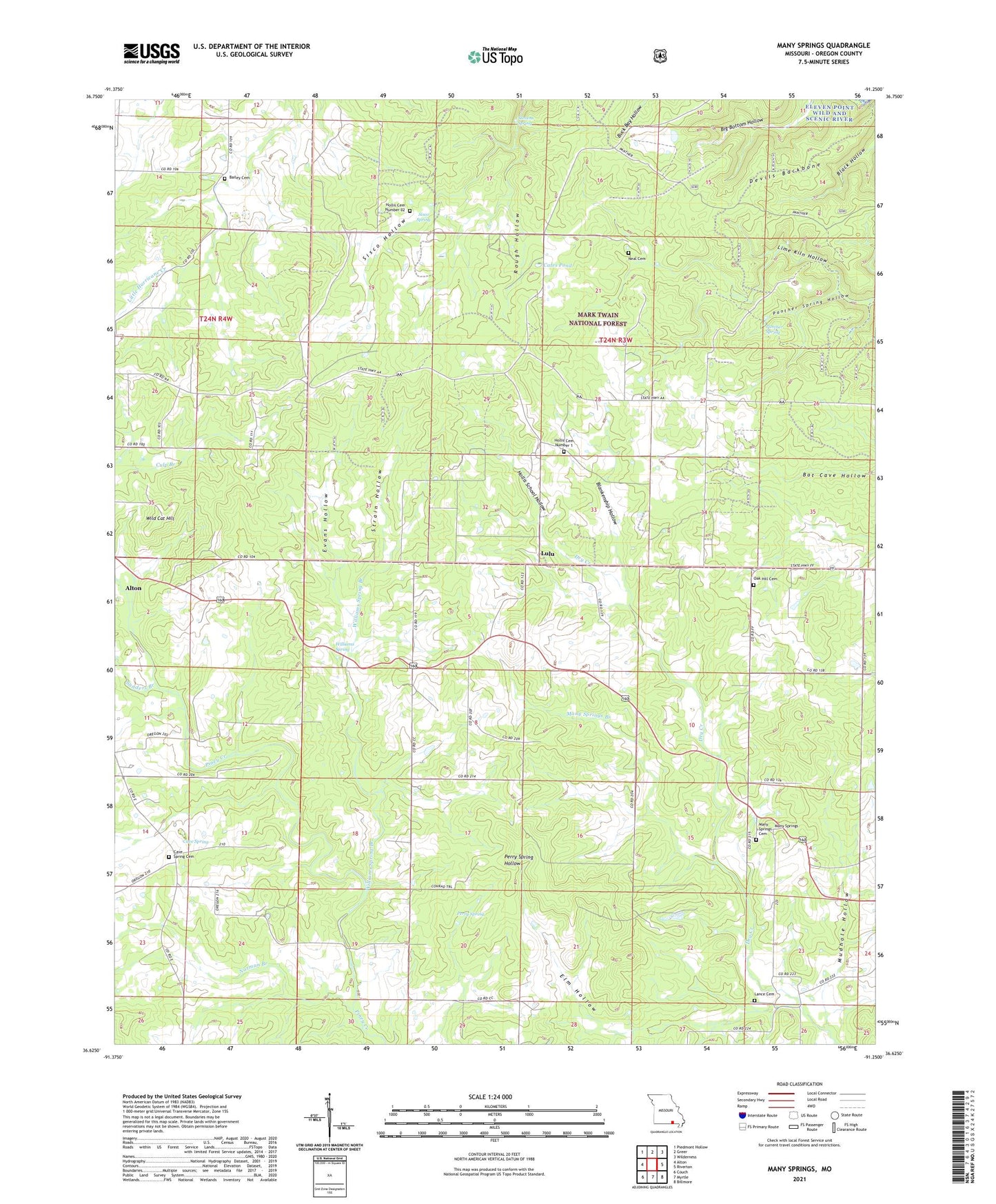
Many Springs Missouri US Topo Map
Couldn't load pickup availability
Also explore the Many Springs Forest Service Topo of this same quad for updated USFS data
2021 topographic map quadrangle Many Springs in the state of Missouri. Scale: 1:24000. Based on the newly updated USGS 7.5' US Topo map series, this map is in the following counties: Oregon. The map contains contour data, water features, and other items you are used to seeing on USGS maps, but also has updated roads and other features. This is the next generation of topographic maps. Printed on high-quality waterproof paper with UV fade-resistant inks.
Quads adjacent to this one:
West: Alton
Northwest: Piedmont Hollow
North: Greer
Northeast: Wilderness
East: Riverton
Southeast: Billmore
South: Myrtle
Southwest: Couch
This map covers the same area as the classic USGS quad with code o36091f3.
Contains the following named places: Allen Chapel, Antioch Church, Bailey Cemetery, Bailey Church, Billdad School, Blankenship Hollow, Braswell, Braswell Lookout, Braswell Lookout Tower, Cates Pond, Cates Pond Church, Cave Spring, Cave Spring Cemetery, Cave Spring School, Cave Springs Church, Devils Backbone, Elm Hollow, Evans Hollow, Hollis, Hollis Cemetery Number 02, Hollis Cemetery Number 1, Hollis School, Hollis School Hollow, Lance Cemetery, Lime Kiln Hollow, Lula Church, Lulu, Many Springs, Many Springs Branch, Mudhole Hollow, Neal Cemetery, Nebo Church, Nebo School, Norman Branch, Oak Hill Church, Oak Hill School, Panther Spring, Perry Spring, Pleasant Ridge Church, Rough Hollow, Sanders Branch, Simpson, Sisco Spring, Stevens Spring, Strain Hollow, Township of Goebel, Wild Cat Hill, Williams Spring, Williams Spring Branch, ZIP Code: 65606