MyTopo
Chilhowee Missouri US Topo Map
Couldn't load pickup availability
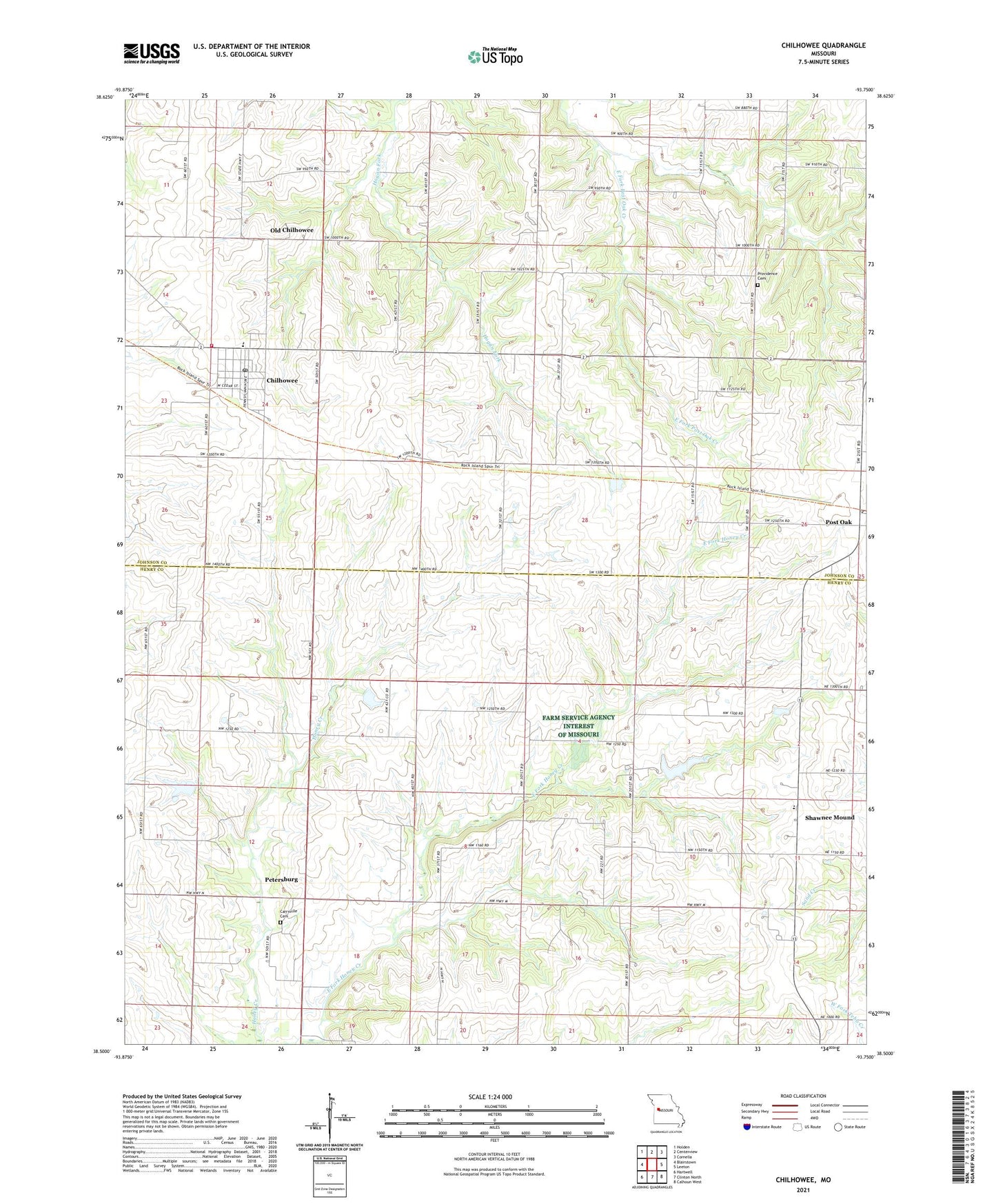
2021 topographic map quadrangle Chilhowee in the state of Missouri. Scale: 1:24000. Based on the newly updated USGS 7.5' US Topo map series, this map is in the following counties: Johnson, Henry. The map contains contour data, water features, and other items you are used to seeing on USGS maps, but also has updated roads and other features. This is the next generation of topographic maps. Printed on high-quality waterproof paper with UV fade-resistant inks.
Quads adjacent to this one:
West: Blairstown
Northwest: Holden
North: Centerview
Northeast: Cornelia
East: Leeton
Southeast: Calhoun West
South: Clinton North
Southwest: Hartwell
This map covers the same area as the classic USGS quad with code o38093e7.
Contains the following named places: Agricola School, Carrsville Cemetery, Chilhowee, Chilhowee Elementary School, Chilhowee High School, Chilhowee Post Office, Corinth Church, Dunham School, Green Lake Dam, Johnson County Fire Protection District Station 3 Chilhowee, Little Grant School, Norcross Farm Lake Dam, Oak Grove School, Old Chilhowee, Petersburg, Post Oak, Providence Cemetery, Rocky Point School, Shawnee Elementary School, Shawnee Mound, Shawnee Mound Church, Shiloh Church, Stropes Lake Dam, Town of Chilhowee, Township of Chilhowee, Township of Shawnee, Williams Lake Dam, ZIP Code: 64733