MyTopo
Brandsville Missouri US Topo Map
Couldn't load pickup availability
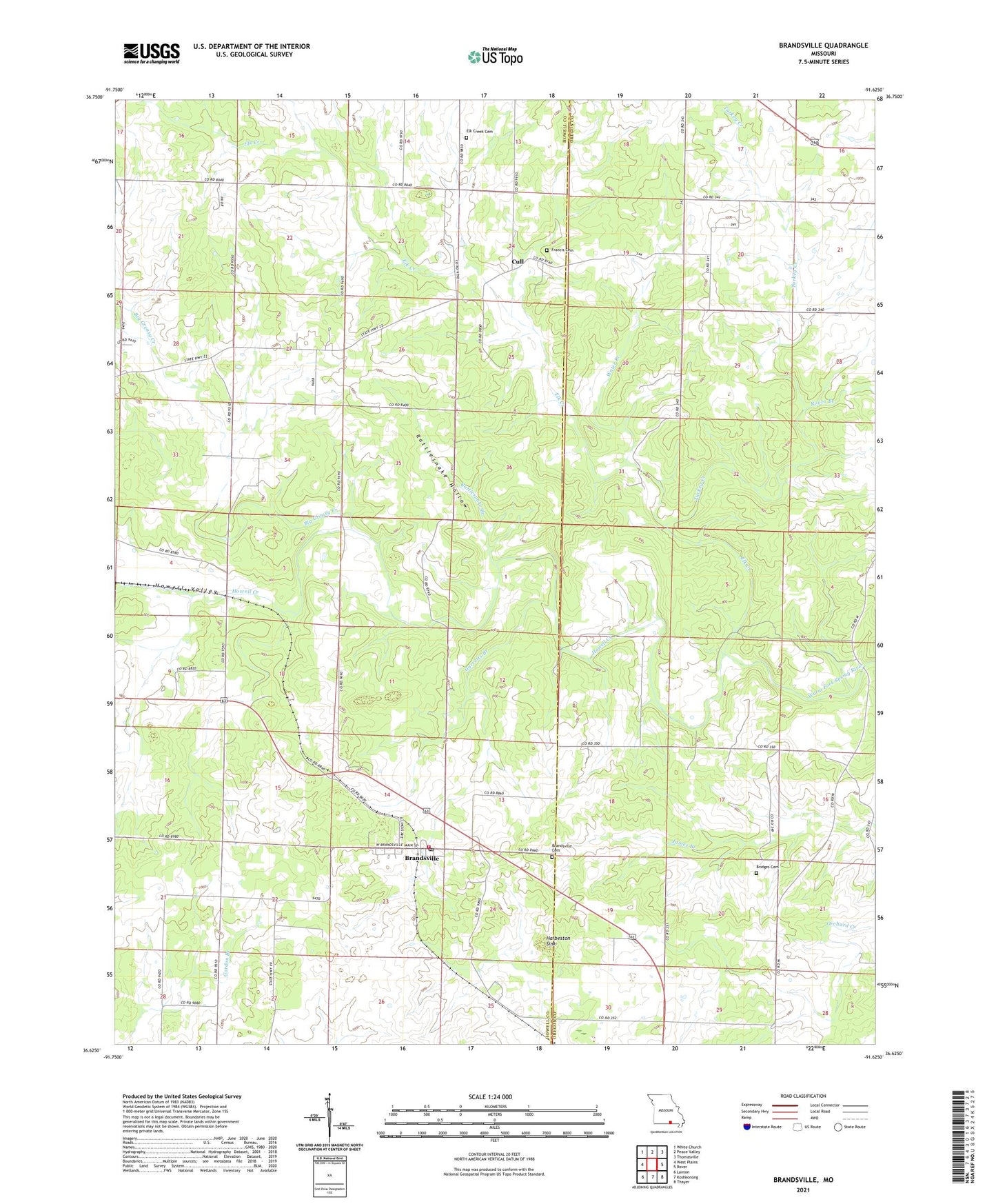
2021 topographic map quadrangle Brandsville in the state of Missouri. Scale: 1:24000. Based on the newly updated USGS 7.5' US Topo map series, this map is in the following counties: Howell, Oregon. The map contains contour data, water features, and other items you are used to seeing on USGS maps, but also has updated roads and other features. This is the next generation of topographic maps. Printed on high-quality waterproof paper with UV fade-resistant inks.
Quads adjacent to this one:
West: West Plains
Northwest: White Church
North: Peace Valley
Northeast: Thomasville
East: Rover
Southeast: Thayer
South: Koshkonong
Southwest: Lanton
Contains the following named places: Adams School, Big Apple School, Brandsville, Brandsville Fire Department, Brandsville Post Office, City of Brandsville, Cull, Cull Post Office, Elk Creek, Elk Creek Cemetery, Elk Creek Church, Elk Creek School, Francis Cemetery, Garretts Branch, Harbeston Sink, Howell Valley, Hunter Crossing, New Attie School, Omrie Sinclair Dam, Pocohontas Crossing, Rattlesnake Branch, Rattlesnake Hollow, Rover Branch, Summers School, Turkey Creek, Union Hill Church, Victory Mission Church, Water Branch, ZIP Code: 65692