MyTopo
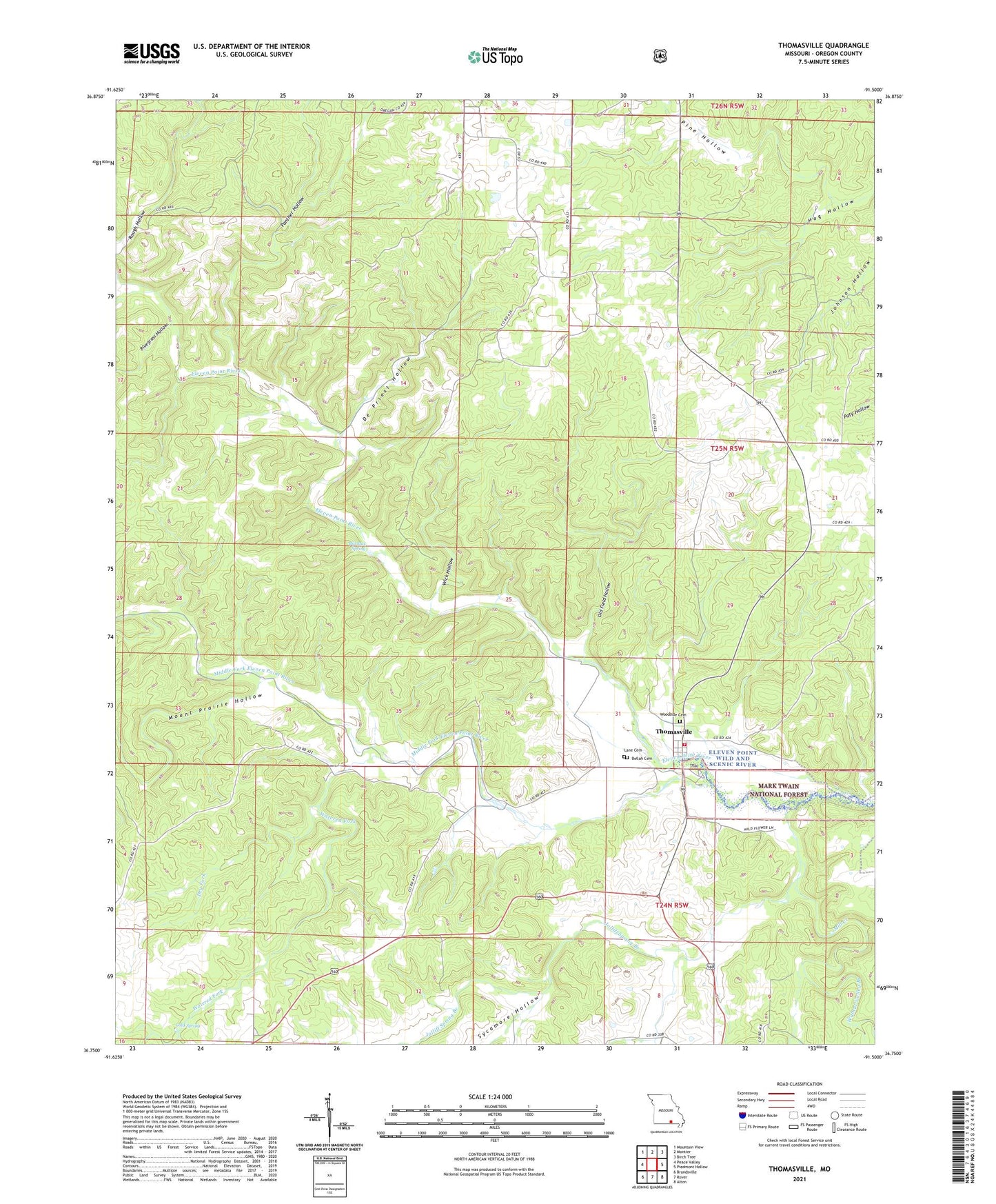
Thomasville Missouri US Topo Map
Couldn't load pickup availability
Also explore the Thomasville Forest Service Topo of this same quad for updated USFS data
2021 topographic map quadrangle Thomasville in the state of Missouri. Scale: 1:24000. Based on the newly updated USGS 7.5' US Topo map series, this map is in the following counties: Oregon. The map contains contour data, water features, and other items you are used to seeing on USGS maps, but also has updated roads and other features. This is the next generation of topographic maps. Printed on high-quality waterproof paper with UV fade-resistant inks.
Quads adjacent to this one:
West: Peace Valley
Northwest: Mountain View
North: Montier
Northeast: Birch Tree
East: Piedmont Hollow
Southeast: Alton
South: Rover
Southwest: Brandsville
This map covers the same area as the classic USGS quad with code o36091g5.
Contains the following named places: Barren Fork, Bellah Cemetery, Bill Mac Spring, Bluegrass Hollow, Cold Spring, De Priest Hollow, Dry Fork, Jolliff Spring Branch, Knob Hill School, Lane Cemetery, Middle Fork Eleven Point River, Mill Creek, Mount Prairie Branch, Mount Prairie Hollow, Old Field Hollow, Olds Mill, Panther Hollow, Pine Hill Church, Pine Hollow, Seven Points Hills, Sherwood Reese Ranch, Sycamore Hollow, Thomasville, Thomasville Census Designated Place, Thomasville Rural Fire Department, Township of Black Pond, Township of Moore, Walnut Valley Branch, Watered Fork, Wick Hollow