MyTopo
Rover Missouri US Topo Map
Couldn't load pickup availability
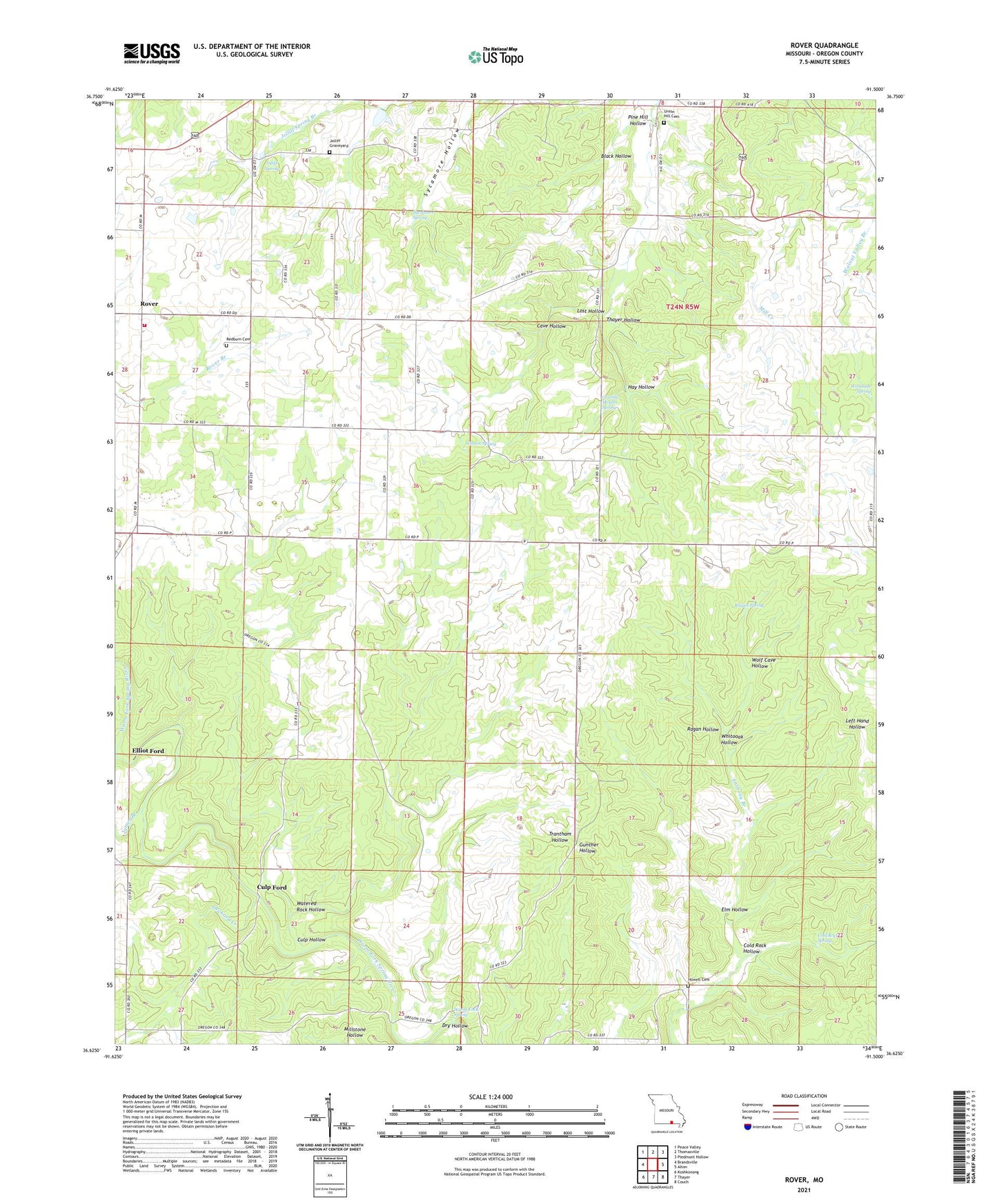
2021 topographic map quadrangle Rover in the state of Missouri. Scale: 1:24000. Based on the newly updated USGS 7.5' US Topo map series, this map is in the following counties: Oregon. The map contains contour data, water features, and other items you are used to seeing on USGS maps, but also has updated roads and other features. This is the next generation of topographic maps. Printed on high-quality waterproof paper with UV fade-resistant inks.
Quads adjacent to this one:
West: Brandsville
Northwest: Peace Valley
North: Thomasville
Northeast: Piedmont Hollow
East: Alton
Southeast: Couch
South: Thayer
Southwest: Koshkonong
This map covers the same area as the classic USGS quad with code o36091f5.
Contains the following named places: Bales School, Black Hollow, Brady, Brady Post Office, Cave Hollow, Cold Rock Hollow, Cold Rock Spring, Culp Ford, Culp Hollow, Dry Hollow, Elliot Ford, Elm Hollow, English School, Granny Meyers Spring, Hay Hollow, Howell Cemetery, Howell Creek, James Branch, Jolliff Graveyard, Jolliff School, Jolliff Spring, Lost Hollow, Mount Pleasant School, Oak Grove School, Orchard Creek, Pine Hill Hollow, Ragan Hollow, Ragan Spring, Redburn Cemetery, Redburn Church, Rover, Rover Volunteer Fire Department, Sycamore Spring, Thayer Hollow, Township of Highland, Union Hill Cemetery, Union Hill Church, Warm Fork Spring, Watered Rock Hollow, Watson Spring, Whitooak Hollow, Wolf Cave Hollow, Woodside Spring