MyTopo
Peace Valley Missouri US Topo Map
Couldn't load pickup availability
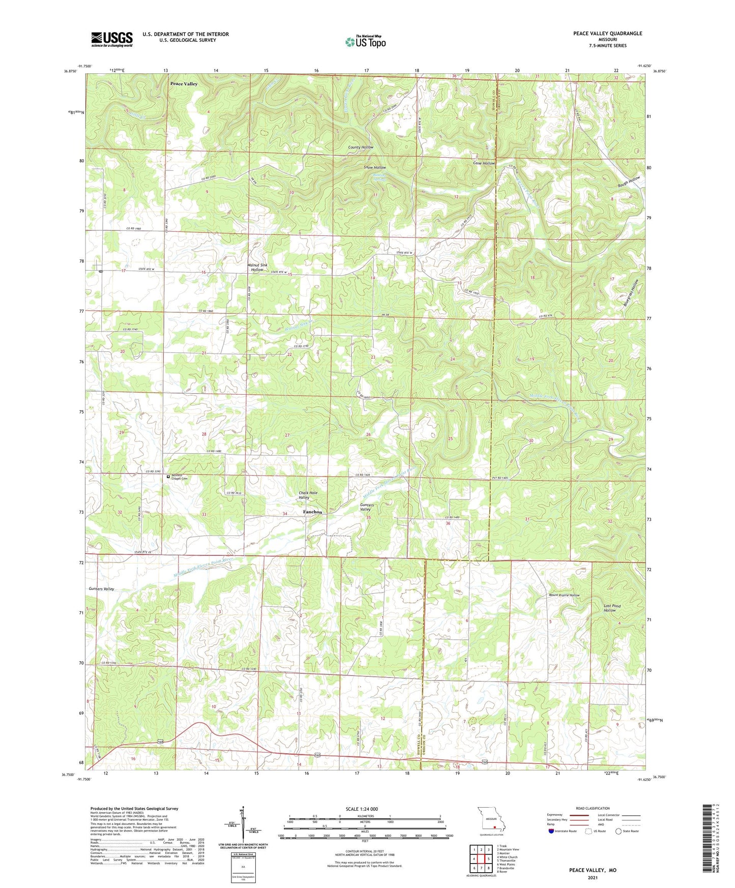
2021 topographic map quadrangle Peace Valley in the state of Missouri. Scale: 1:24000. Based on the newly updated USGS 7.5' US Topo map series, this map is in the following counties: Howell, Oregon. The map contains contour data, water features, and other items you are used to seeing on USGS maps, but also has updated roads and other features. This is the next generation of topographic maps. Printed on high-quality waterproof paper with UV fade-resistant inks.
Quads adjacent to this one:
West: White Church
Northwest: Trask
North: Mountain View
Northeast: Montier
East: Thomasville
Southeast: Rover
South: Brandsville
Southwest: West Plains
This map covers the same area as the classic USGS quad with code o36091g6.
Contains the following named places: Bennett Chapel, Blowing Springs, Cane Hollow, Chalk Hole Valley, County Hollow, Courtois Hills, Dalton School, Fanchon, Ferguson School, Forest View School, Gunters Valley, Hilltop Holiness Church, Hughlett School, Little Creek, Lost Pond Hollow, Lost Pond School, Peace Valley, Peace Valley - White Church Volunteer Station 2, Peace Valley High School, Peace Valley Post Office, Pilgrims Rest Church, Riggs School, Rough Hollow, Snow Hollow, Walnut Sink Creek, Walnut Sink Hollow, ZIP Code: 65788