MyTopo
Brazito Missouri US Topo Map
Couldn't load pickup availability
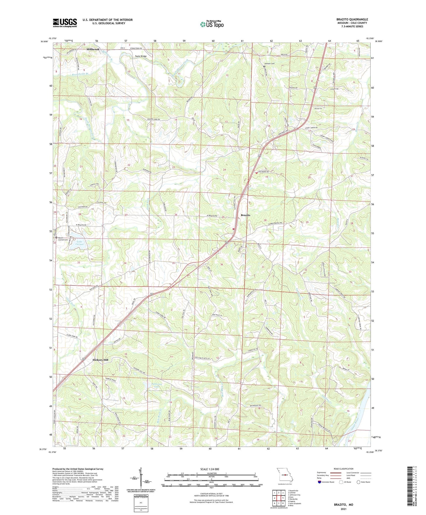
2021 topographic map quadrangle Brazito in the state of Missouri. Scale: 1:24000. Based on the newly updated USGS 7.5' US Topo map series, this map is in the following counties: Cole. The map contains contour data, water features, and other items you are used to seeing on USGS maps, but also has updated roads and other features. This is the next generation of topographic maps. Printed on high-quality waterproof paper with UV fade-resistant inks.
Quads adjacent to this one:
West: Enon
Northwest: Russellville
North: Lohman
Northeast: Jefferson City
East: Wardsville
Southeast: Meta
South: Saint Elizabeth
Southwest: Eugene
Contains the following named places: Ambrose School, Bass, Brazito, Centennial School, Clark Fork, Cole County Fire Protection District Station 2, Cole County Fire Protection District Station 8, Glendale School, Hickory Hill, Johnson Cemetery, Lake Carmel, Lake Carmel Dam, Landing Creek, Mar-Kay Lake Dam, Millbrook, Millbrook Branch, Mount Carmel Cemetery, Mount Carmel School, North Moreau Creek, Number 848 Dam, Oak Grove School, Patterson Lake, Pleasant Hill Church, Pleasant Hill School, Pleasant Valley School, Russellville Branch, Starr Lake Dam, Taylor Bridge, Township of Clark