MyTopo
Enon Missouri US Topo Map
Couldn't load pickup availability
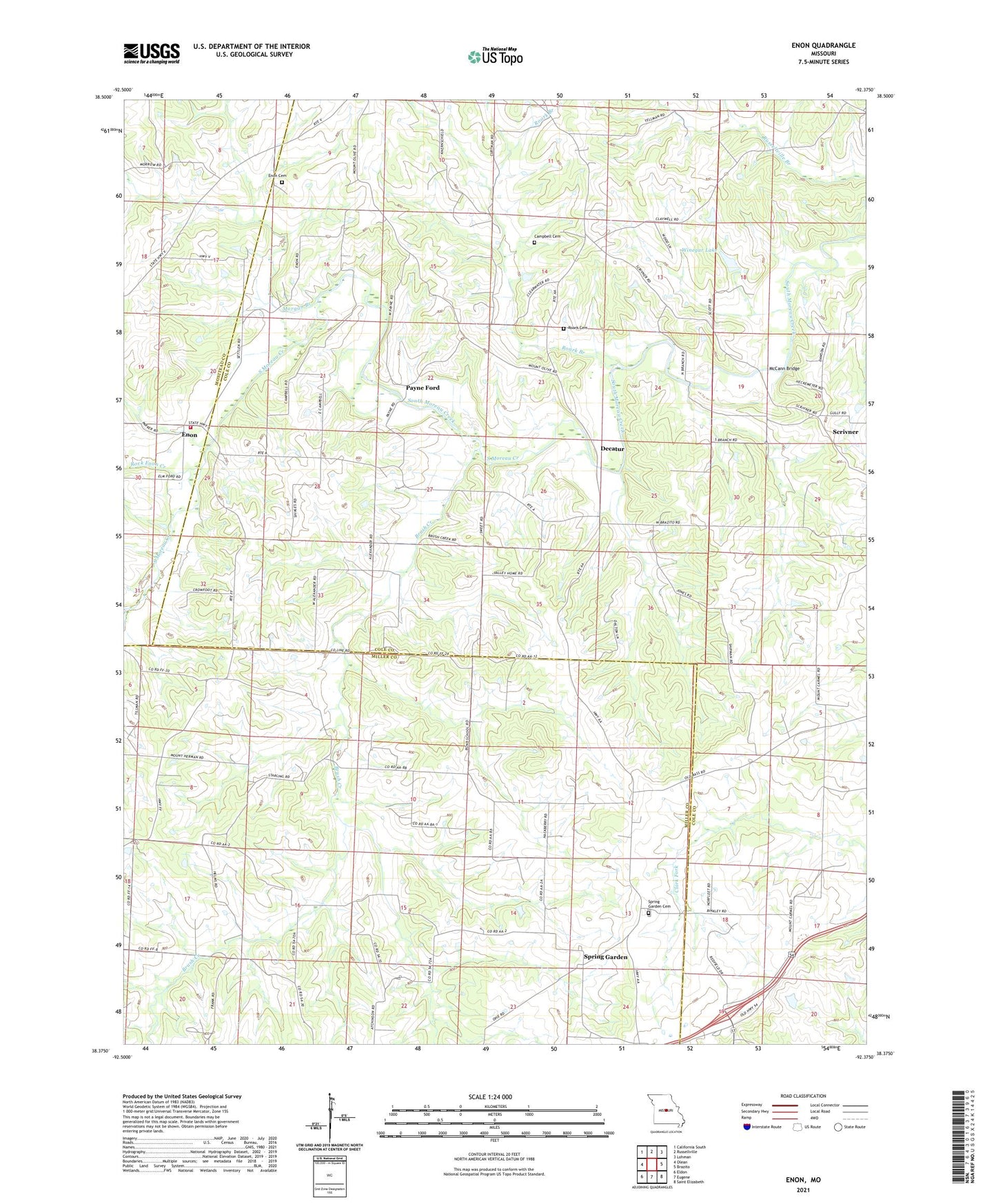
2021 topographic map quadrangle Enon in the state of Missouri. Scale: 1:24000. Based on the newly updated USGS 7.5' US Topo map series, this map is in the following counties: Cole, Miller, Moniteau. The map contains contour data, water features, and other items you are used to seeing on USGS maps, but also has updated roads and other features. This is the next generation of topographic maps. Printed on high-quality waterproof paper with UV fade-resistant inks.
Quads adjacent to this one:
West: Olean
Northwest: California South
North: Russellville
Northeast: Lohman
East: Brazito
Southeast: Saint Elizabeth
South: Eugene
Southwest: Eldon
This map covers the same area as the classic USGS quad with code o38092d4.
Contains the following named places: Bend School, Blythes Creek, Brush Creek, Campbell Cemetery, Campbell Ford, Cottage Grove School, Decatur, Enon, Enon Cemetery, Enterprise School, Jones Branch, McCann Bridge, Miller School, Morgan Branch, Mount Hermon Church, Mount Hermon School, Mount Olive Church, Mount Union Church, New Zion School, Payne Ford, Pleasant Grove School, Roark Branch, Roark Cemetery, Rock Enon Creek, Russellville - Lohman Fire Protection District Station 3 Enon, Scrivner, Scrivner Road State Wildlife Area, Sherwood School, Spring Garden, Spring Garden Cemetery, Spring Rock Lake Dam, Valley Home School, Washburn Lake Dam, Winegar Lake, Winegar Lake Dam, ZIP Codes: 65064, 65074