MyTopo
Eugene Missouri US Topo Map
Couldn't load pickup availability
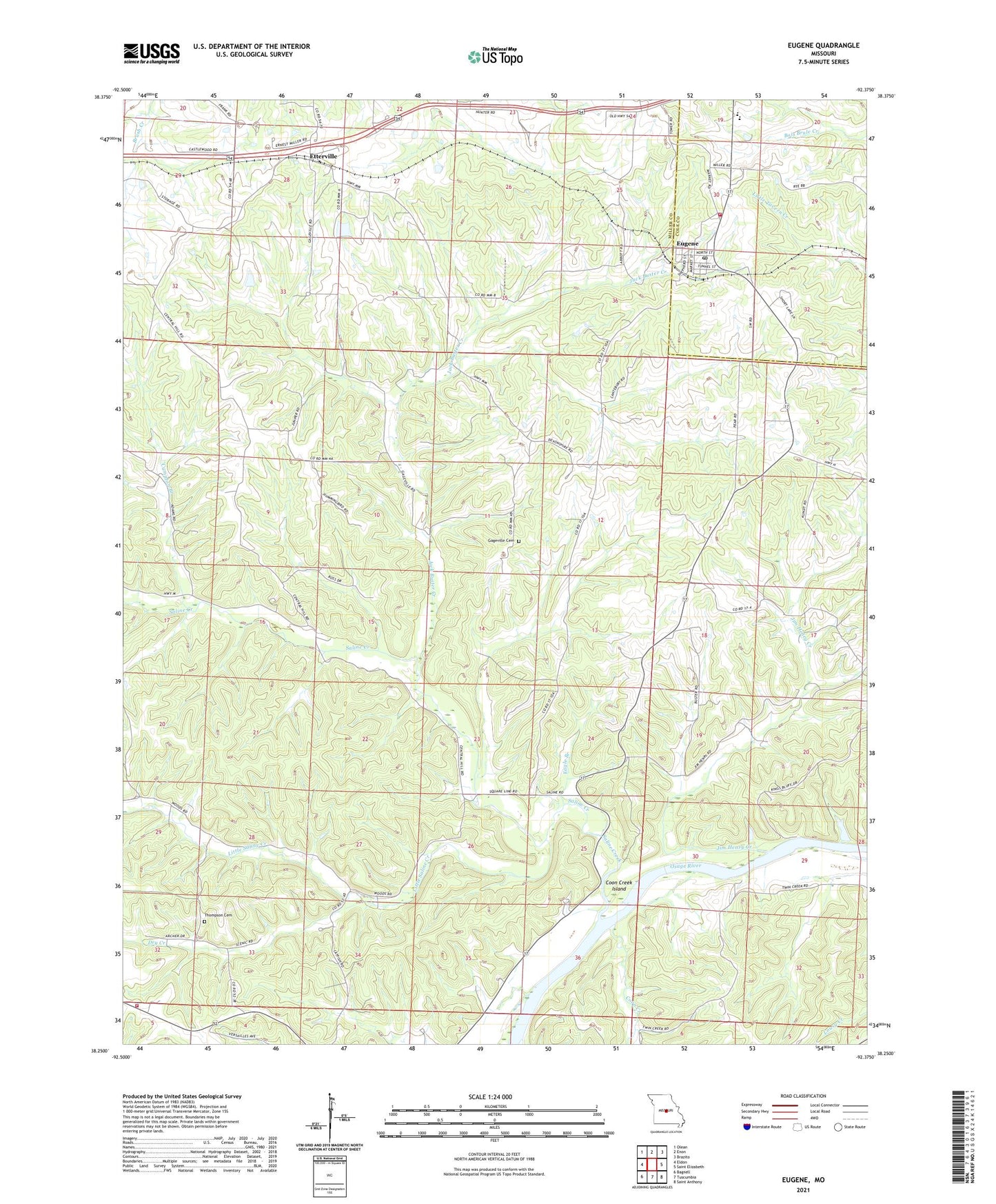
2021 topographic map quadrangle Eugene in the state of Missouri. Scale: 1:24000. Based on the newly updated USGS 7.5' US Topo map series, this map is in the following counties: Miller, Cole. The map contains contour data, water features, and other items you are used to seeing on USGS maps, but also has updated roads and other features. This is the next generation of topographic maps. Printed on high-quality waterproof paper with UV fade-resistant inks.
Quads adjacent to this one:
West: Eldon
Northwest: Olean
North: Enon
Northeast: Brazito
East: Saint Elizabeth
Southeast: Saint Anthony
South: Tuscumbia
Southwest: Bagnell
This map covers the same area as the classic USGS quad with code o38092c4.
Contains the following named places: Bittle Dam, Butzer Lake Dam, Central Church, Cole County Fire Protection District Station 5, Coon Creek, Coon Creek Island, Cumpton Branch, Dry Creek, Eagle Branch, Etterville, Eugene, Eugene Census Designated Place, Eugene Elementary School, Eugene High School, Eugene Post Office, Gageville Cemetery, Gageville School, Gleenwood Church, Harbison School, Jack Buster Creek, Jim Henry Creek, Jim Henry School, Kings Bluff State Wildlife Area, Little Saline Creek, Munson Dam, Pleasant Ball School, Rock House, Rush Chapel, Saline Creek, Saline Valley Church, Saline Valley State Wildlife Area, State of Missouri, Thompson Cemetery, Township of Jim Henry, Tuscumbia Fire Department, Waterloo School, Wright School, ZIP Code: 65032