MyTopo
Downing Missouri US Topo Map
Couldn't load pickup availability
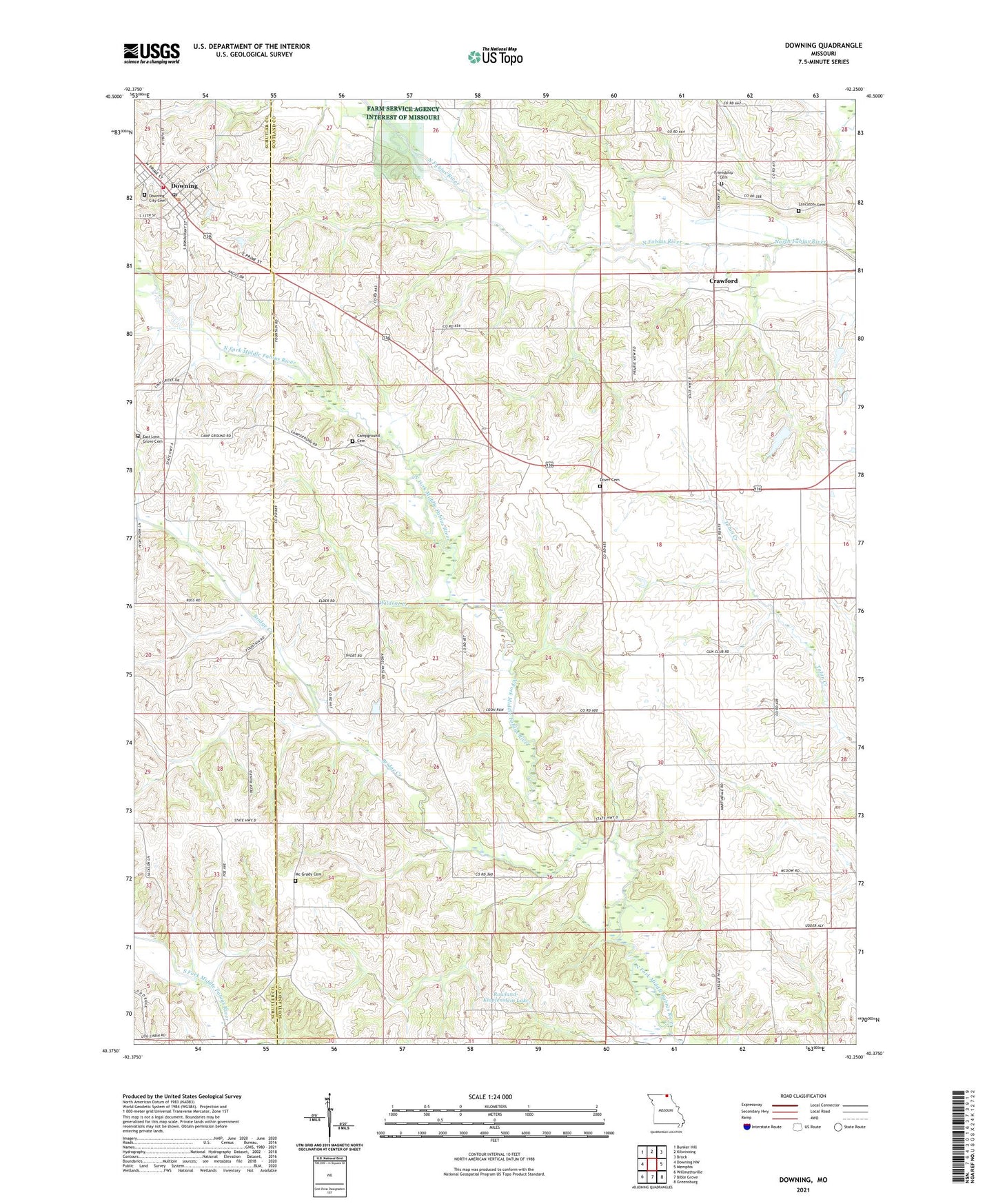
2021 topographic map quadrangle Downing in the state of Missouri. Scale: 1:24000. Based on the newly updated USGS 7.5' US Topo map series, this map is in the following counties: Scotland, Schuyler. The map contains contour data, water features, and other items you are used to seeing on USGS maps, but also has updated roads and other features. This is the next generation of topographic maps. Printed on high-quality waterproof paper with UV fade-resistant inks.
Quads adjacent to this one:
West: Downing NW
Northwest: Bunker Hill
North: Kilwinning
Northeast: Brock
East: Memphis
Southeast: Greensburg
South: Bible Grove
Southwest: Willmathsville
This map covers the same area as the classic USGS quad with code o40092d3.
Contains the following named places: Bridge Creek, Campground Cemetery, City of Downing, Crawford, Cumberland Church, Dover Baptist Church, Dover Cemetery, Dover School, Downing, Downing City Cemetery, Downing Community Fire Association Storage Facility, Downing Community Fire Rescue Association Main Station, Downing Post Office, East Lynn Grove Cemetery, East Lynn Grove School, Energy, Friendship Cemetery, Friendship School, Jack Blessing Lake Dam, Jake Blessing Lake Section 12 Dam, Jake Blessing Lake Section 8 Dam, Lancaster Cemetery, Loe School, Mc Grady Cemetery, McGrady Cumberland Presbyterian Church, Middle Fabius, Middle Fabius School, Prairie View School, Pronax, Rowland-Klopfenstein Lake, South barker School, Township of Vest, Unity, Unity Post Office, Walnut Grove School, Wildcat Creek, ZIP Code: 63536