MyTopo
Brookfield Missouri US Topo Map
Couldn't load pickup availability
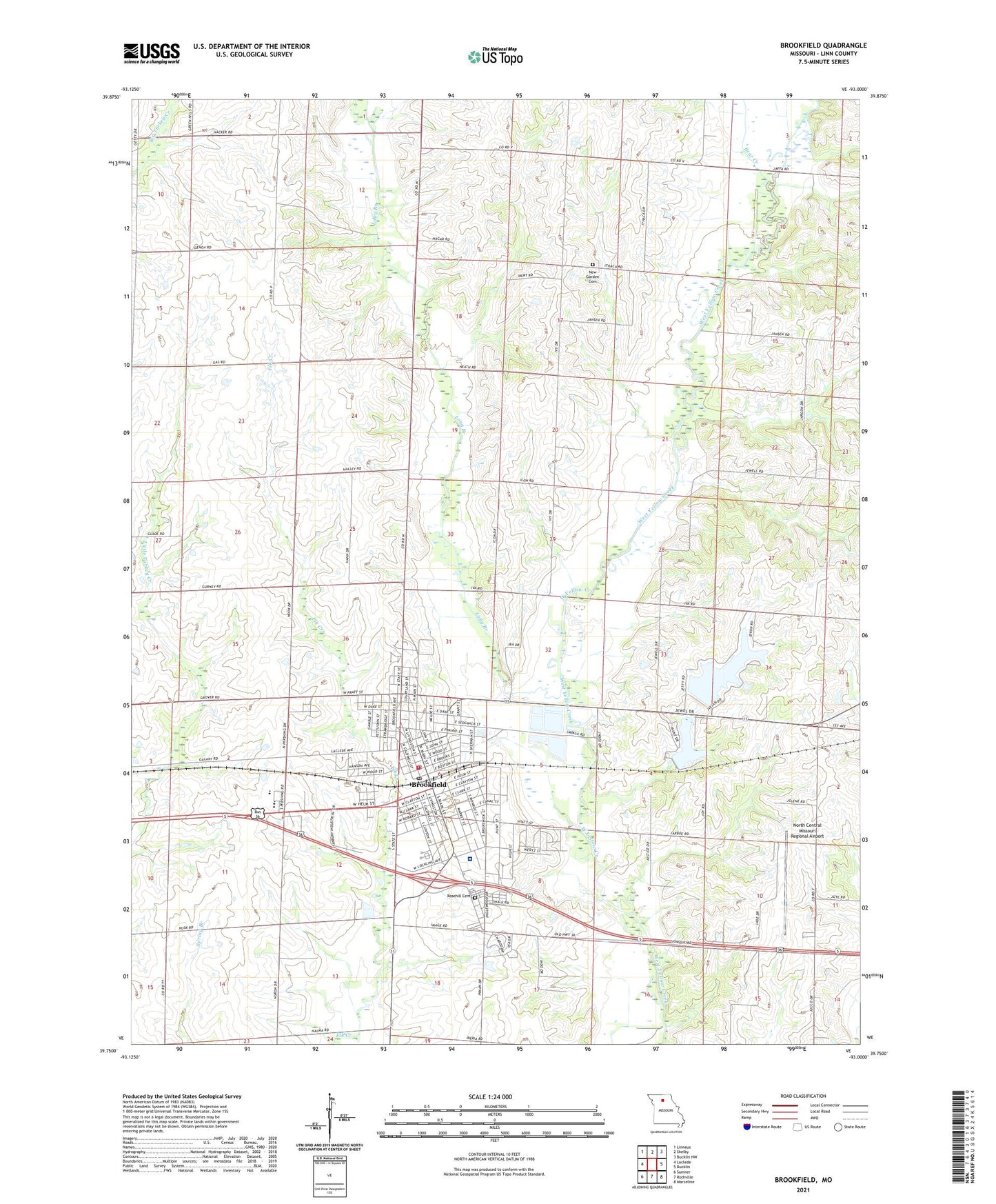
2021 topographic map quadrangle Brookfield in the state of Missouri. Scale: 1:24000. Based on the newly updated USGS 7.5' US Topo map series, this map is in the following counties: Linn. The map contains contour data, water features, and other items you are used to seeing on USGS maps, but also has updated roads and other features. This is the next generation of topographic maps. Printed on high-quality waterproof paper with UV fade-resistant inks.
Quads adjacent to this one:
West: Laclede
Northwest: Linneus
North: Shelby
Northeast: Bucklin NW
East: Bucklin
Southeast: Marceline
South: Rothville
Southwest: Sumner
Contains the following named places: Bear Creek, Brookfield, Brookfield City Dam, Brookfield Country Club Dam, Brookfield Country Club Lake, Brookfield Lake, Brookfield Plaza, Brookfield Police Department, Brookfield Post Office, Brookfield Reservoir, Brookfield Reservoir Dam, Brookfield Rural Fire Department, Brookfield Volunteer Fire Department, Bruner School, Burch School, Carey School, City Lake, City of Brookfield, Crescent School, General John J Pershing Memorial Airport, General John J Pershing Memorial Hospital, General John J Pershing Memorial Hospital Heliport, KGNG-AM (Brookfield), KZBK-FM (Brookfield), Linheart Church, Linn Center School, Linn County, Long Branch, McClure School, Moore School, New Garden Cemetery, New Garden Church, North Central Missouri Regional Airport, Prairie Flower School, Rosehill Cemetery, Township of Brookfield, Troutman Airport, ZIP Code: 64628