MyTopo
Laclede Missouri US Topo Map
Couldn't load pickup availability
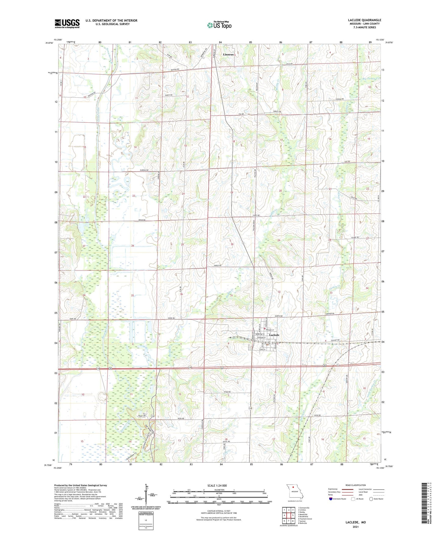
2021 topographic map quadrangle Laclede in the state of Missouri. Scale: 1:24000. Based on the newly updated USGS 7.5' US Topo map series, this map is in the following counties: Linn. The map contains contour data, water features, and other items you are used to seeing on USGS maps, but also has updated roads and other features. This is the next generation of topographic maps. Printed on high-quality waterproof paper with UV fade-resistant inks.
Quads adjacent to this one:
West: Meadville
Northwest: Eversonville
North: Linneus
Northeast: Shelby
East: Brookfield
Southeast: Rothville
South: Sumner
Southwest: Fountain Grove
This map covers the same area as the classic USGS quad with code o39093g2.
Contains the following named places: Big Turkey Creek, City of Laclede, General John J. Pershing Boyhood Home, Higgins Ditch, Kemper Branch, Laclede, Laclede Community Fire Protection District, Laclede Post Office, Locust Creek School, Moore School, Muddy Creek, Needles, Oak Arbor School, Pershing State Park, Plum Grove School, Slater School, Strawberry Branch, Sunny Point School, Township of Jefferson, ZIP Code: 64651