MyTopo
Bruner Missouri US Topo Map
Couldn't load pickup availability
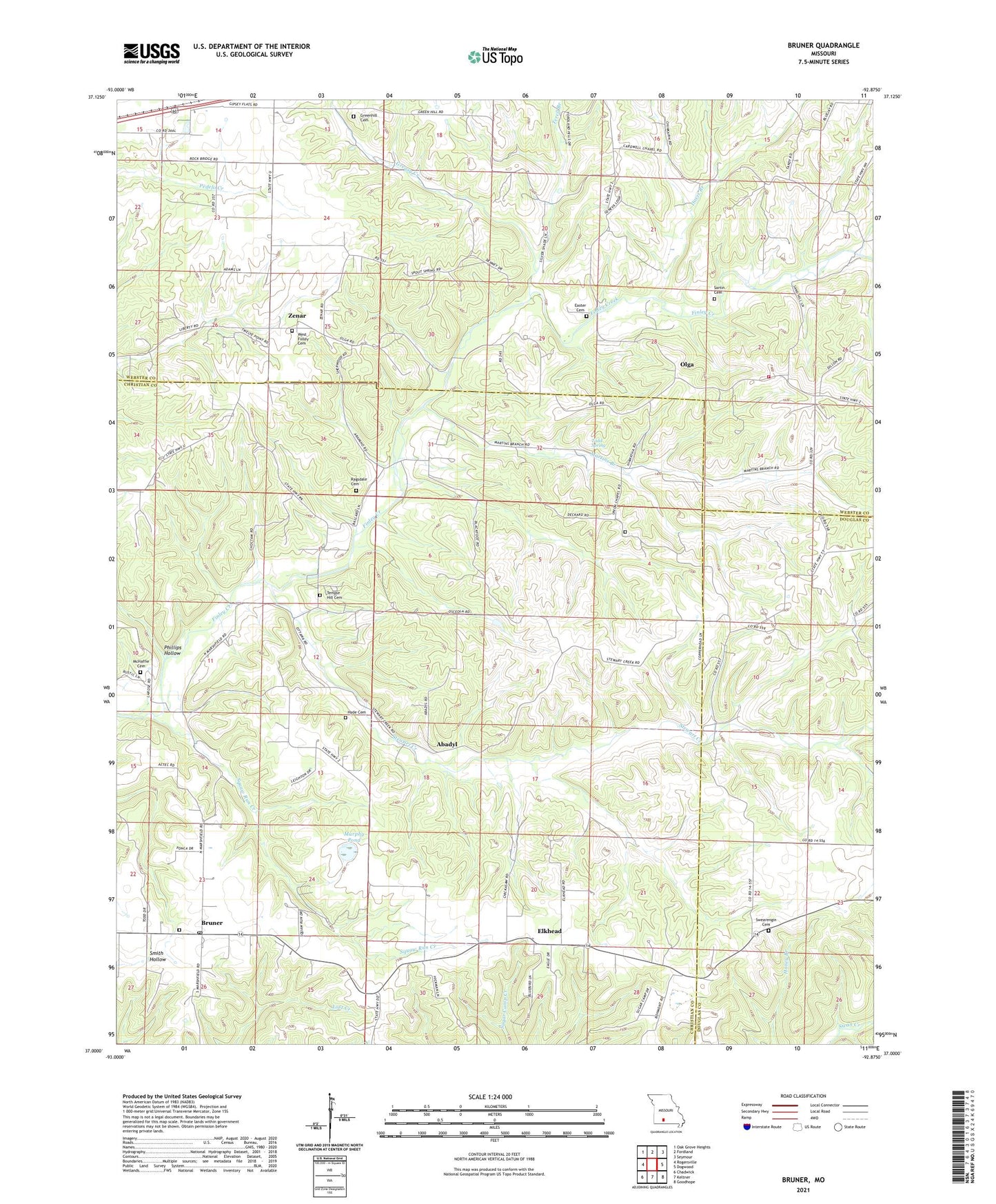
2021 topographic map quadrangle Bruner in the state of Missouri. Scale: 1:24000. Based on the newly updated USGS 7.5' US Topo map series, this map is in the following counties: Christian, Webster, Douglas. The map contains contour data, water features, and other items you are used to seeing on USGS maps, but also has updated roads and other features. This is the next generation of topographic maps. Printed on high-quality waterproof paper with UV fade-resistant inks.
Quads adjacent to this one:
West: Rogersville
Northwest: Oak Grove Heights
North: Fordland
Northeast: Seymour
East: Dogwood
Southeast: Goodhope
South: Keltner
Southwest: Chadwick
Contains the following named places: Abadyl, Bruner, Bruner Church, Bruner Post Office, Bruner School, Davis Branch, Dillon School, Easter Cemetery, Elkhead, Fairview Church, Gertrude, Glesa, Greasy Creek, Green Hill Chapel, Green Hill School, Hyde Cemetery, Johns Mills, La Rose Church, La Rose School, Little Finley Creek, Martins Branch, Mathal, McHaffie Cemetery, McHaffie Church, McHaffie School, Mount Gillian Church, Murphy Pond, Olga, Ozarks Flying Patch Airport, Pauls Lake Dam, Phillips Hollow, Pleasant Hope School, Ragsdale Cemetery, Roberts School, Rogers School, Sartin Cemetery, Sherrow School, Silver Shade School, Southern Webster County Fire Protection District Station 4, Squaw Run Creek, Stewart Creek, Swearengin Cemetery, Temple Hill Cemetery, Temple Hill Church, Terell Branch, Todd Spring, Township of Bruner, Township of East Benton, Township of Green Hill, Township of Spencer, Union Chapel, West Finley Cemetery, West Finley Church, Zenar, ZIP Code: 65620