MyTopo
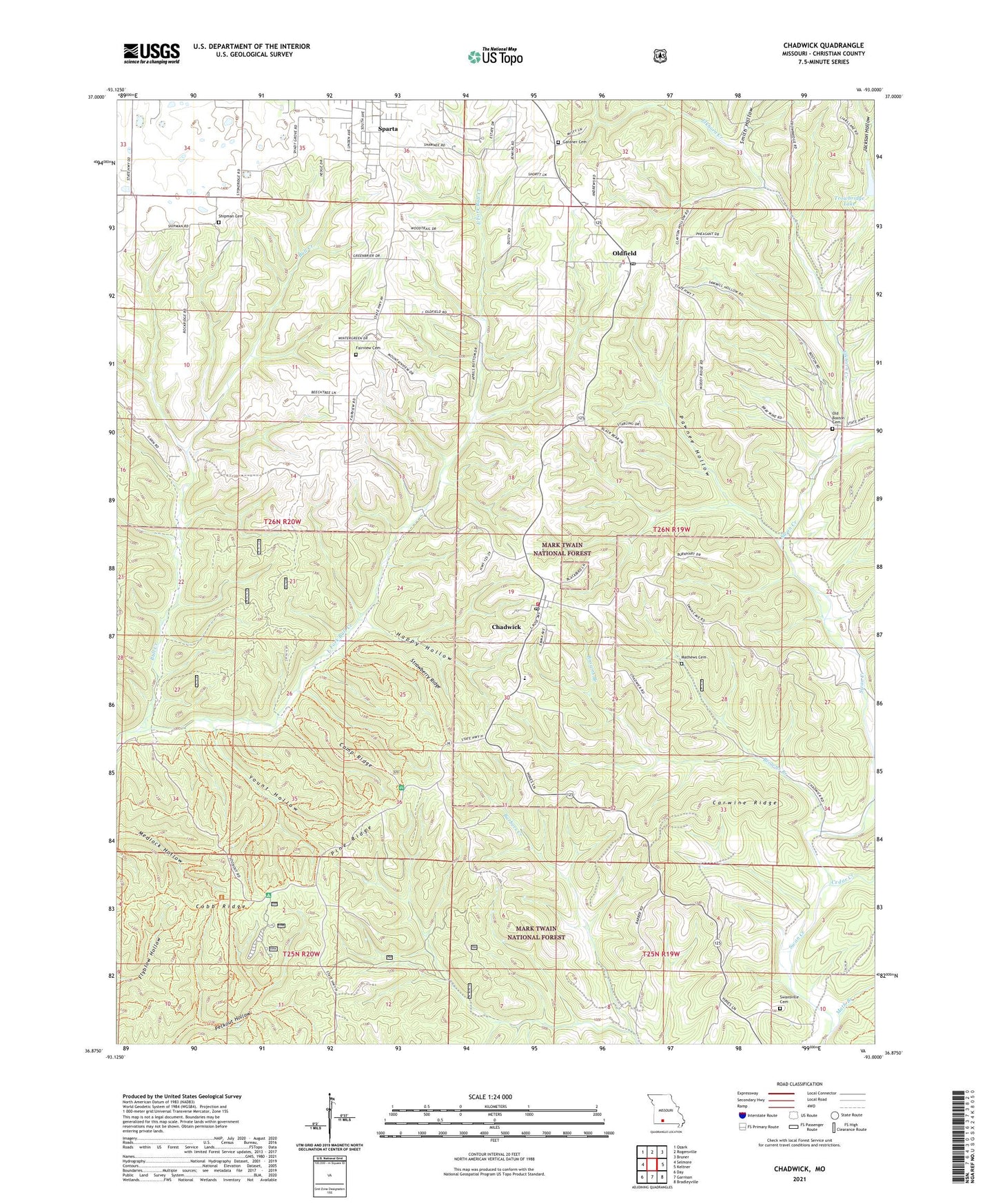
Chadwick Missouri US Topo Map
Couldn't load pickup availability
Also explore the Chadwick Forest Service Topo of this same quad for updated USFS data
2021 topographic map quadrangle Chadwick in the state of Missouri. Scale: 1:24000. Based on the newly updated USGS 7.5' US Topo map series, this map is in the following counties: Christian. The map contains contour data, water features, and other items you are used to seeing on USGS maps, but also has updated roads and other features. This is the next generation of topographic maps. Printed on high-quality waterproof paper with UV fade-resistant inks.
Quads adjacent to this one:
West: Selmore
Northwest: Ozark
North: Rogersville
Northeast: Bruner
East: Keltner
Southeast: Bradleyville
South: Garrison
Southwest: Day
This map covers the same area as the classic USGS quad with code o36093h1.
Contains the following named places: Boston School, Browns Branch, Camp Ridge, Carwine Ridge, Cedar Creek, Chadwick, Chadwick Elementary School, Chadwick High School, Chadwick Post Office, Chadwick Rural Fire Department, Cobb Ridge, East Fork Bull Creek, Elkhorn Creek, Fairview Cemetery, Fairview Church, Gardner Cemetery, Happy Hollow, Jackson Hollow, Math Branch, Mathews Cemetery, Old Boston Cemetery, Oldfield, Oldfield Post Office, Oldfield School, Pawnee Hollow, Pine Ridge, Roller Lake Dam, Saunders, Saunders Lookout Tower, Shipman Cemetery, Smith Hollow, Strawberry Ridge, Swansville Cemetery, Swansville School, Township of Chadwick, Township of Oldfield, Township of Sparta, Trowbridge Lake, Yount Hollow, ZIP Code: 65629