MyTopo
Oak Grove Heights Missouri US Topo Map
Couldn't load pickup availability
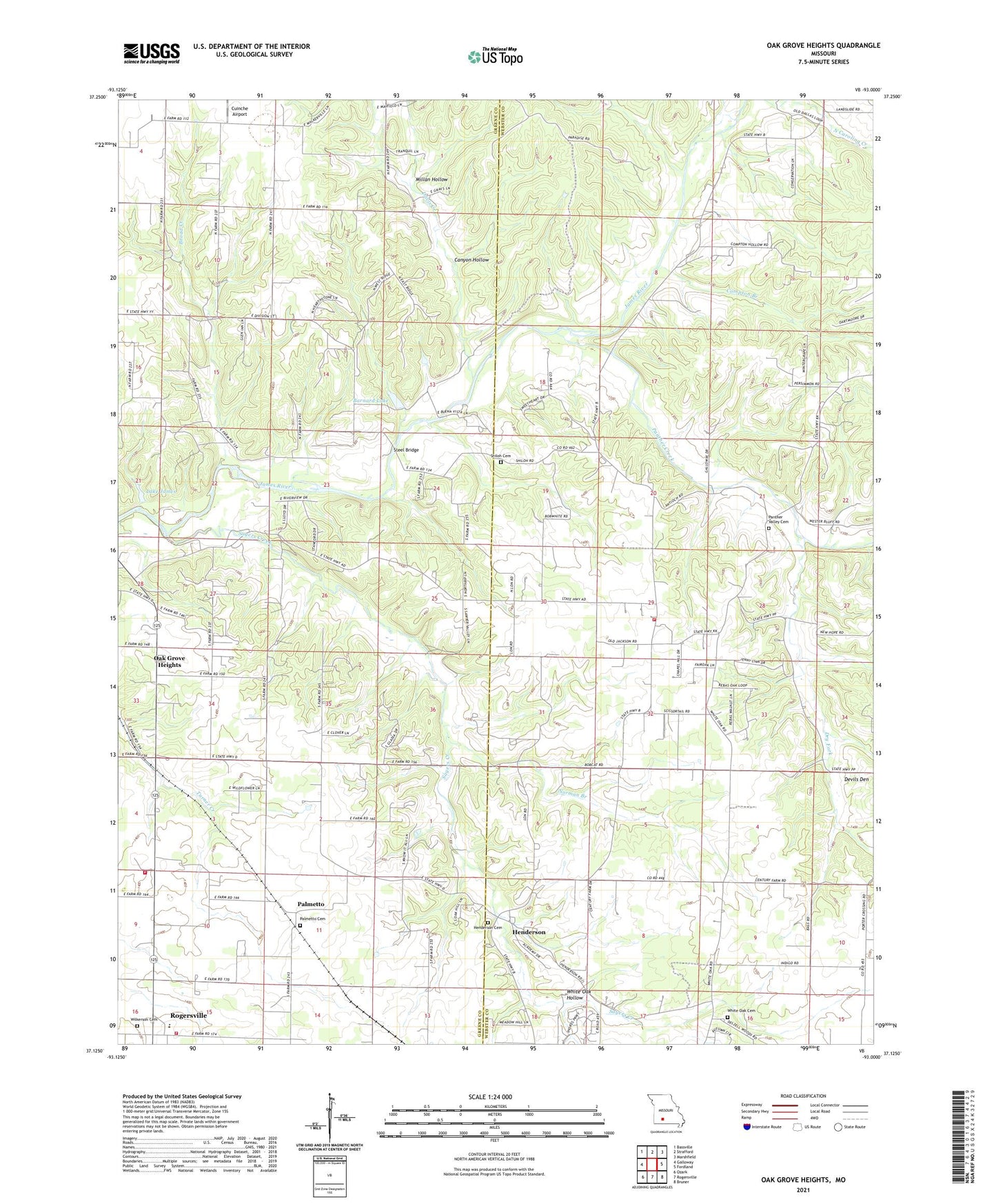
2021 topographic map quadrangle Oak Grove Heights in the state of Missouri. Scale: 1:24000. Based on the newly updated USGS 7.5' US Topo map series, this map is in the following counties: Webster, Greene. The map contains contour data, water features, and other items you are used to seeing on USGS maps, but also has updated roads and other features. This is the next generation of topographic maps. Printed on high-quality waterproof paper with UV fade-resistant inks.
Quads adjacent to this one:
West: Galloway
Northwest: Bassville
North: Strafford
Northeast: Marshfield
East: Fordland
Southeast: Bruner
South: Rogersville
Southwest: Ozark
This map covers the same area as the classic USGS quad with code o37093b1.
Contains the following named places: All, All Post Office, Antioch Church, Barnard Lake, Barnard Lake Dam, Broad Creek, Buckeye School, Buena Vista Track, Canyon Hollow, Compton, Compton Branch, Cuinche Airport, Davis Creek, Devils Den, Dickersons, Dry Fork, Green Hill School, Henderson, Henderson Cemetery, KXUS-FM (Springfield), Lake James, Lake James Dam, Logan - Rogersville Fire Protection District, Logan - Rogersville Fire Protection District Station 4, Logan - Rogersville Fire Protection District Station 5, Lon, Millan Hollow, Mount Pleasant School, Mount Sinai Chapel, Norman Branch, North Star Church, Oak Grove Heights, Old Dallas School, Ozark Church, Palmetto, Palmetto Cemetery, Panther Creek, Panther Valley, Panther Valley Cemetery, Panther Valley School, Pleasant Valley Church, Sayers Creek, Shiloh Church, Steel Bridge, Township of Benton, Township of Taylor, Township of Washington, Township of West Benton, Township of West Dallas, White Oak Church, White Oak Hollow, Whiteoak School, Wilkerson Cemetery, Wilkerson Chapel, Wilkerson Church, ZIP Code: 65742