MyTopo
Burton Missouri US Topo Map
Couldn't load pickup availability
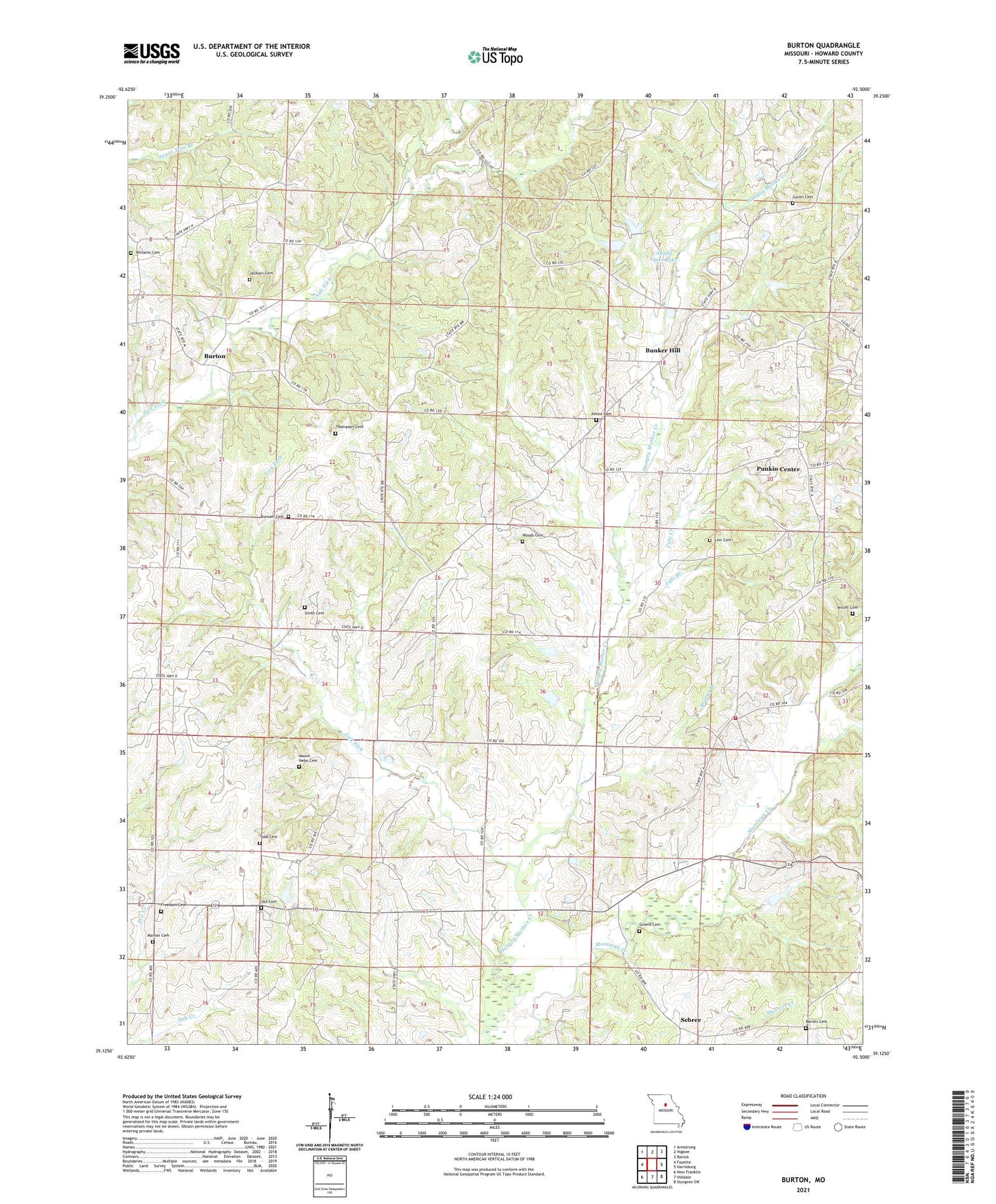
2021 topographic map quadrangle Burton in the state of Missouri. Scale: 1:24000. Based on the newly updated USGS 7.5' US Topo map series, this map is in the following counties: Howard. The map contains contour data, water features, and other items you are used to seeing on USGS maps, but also has updated roads and other features. This is the next generation of topographic maps. Printed on high-quality waterproof paper with UV fade-resistant inks.
Quads adjacent to this one:
West: Fayette
Northwest: Armstrong
North: Higbee
Northeast: Renick
East: Harrisburg
Southeast: Sturgeon SW
South: Hilldale
Southwest: New Franklin
Contains the following named places: Ancell Cemetery, Atkins Cemetery, Baldridge School, Barnes Cemetery, Bethel Church, Braggs Branch, Bunker Hill, Burnam Cemetery, Burton, Cole Creek, Dougherty Park, Freedom Cemetery, Givens Cemetery, Givens School, Guren Cemetery, Hocker School, Howard County Fire Protection District Station 3, Howard County Infirmary, Jackson Cemetery, Lay Chapel, Lick Fork, Linn Cemetery, Locust Grove School, Log Chapel, Lyle Branch, Manion Cemetery, Mobley School, Mount Gilead Church, Mount Nebo Cemetery, Mount Pleasant Church, Myers Chapel, Myers High School, New Hope Church, Okland School, Old Cemetery, Palmer Lake Dam, Potter Branch, Punkin Center, Sebree, Shady Oaks Lake, Smith Cemetery, Thompson Cemetery, Todd Cemetery, Township of Bonne Femme, Township of Burton, Williams Cemetery, Woods Cemetery