MyTopo
Harrisburg Missouri US Topo Map
Couldn't load pickup availability
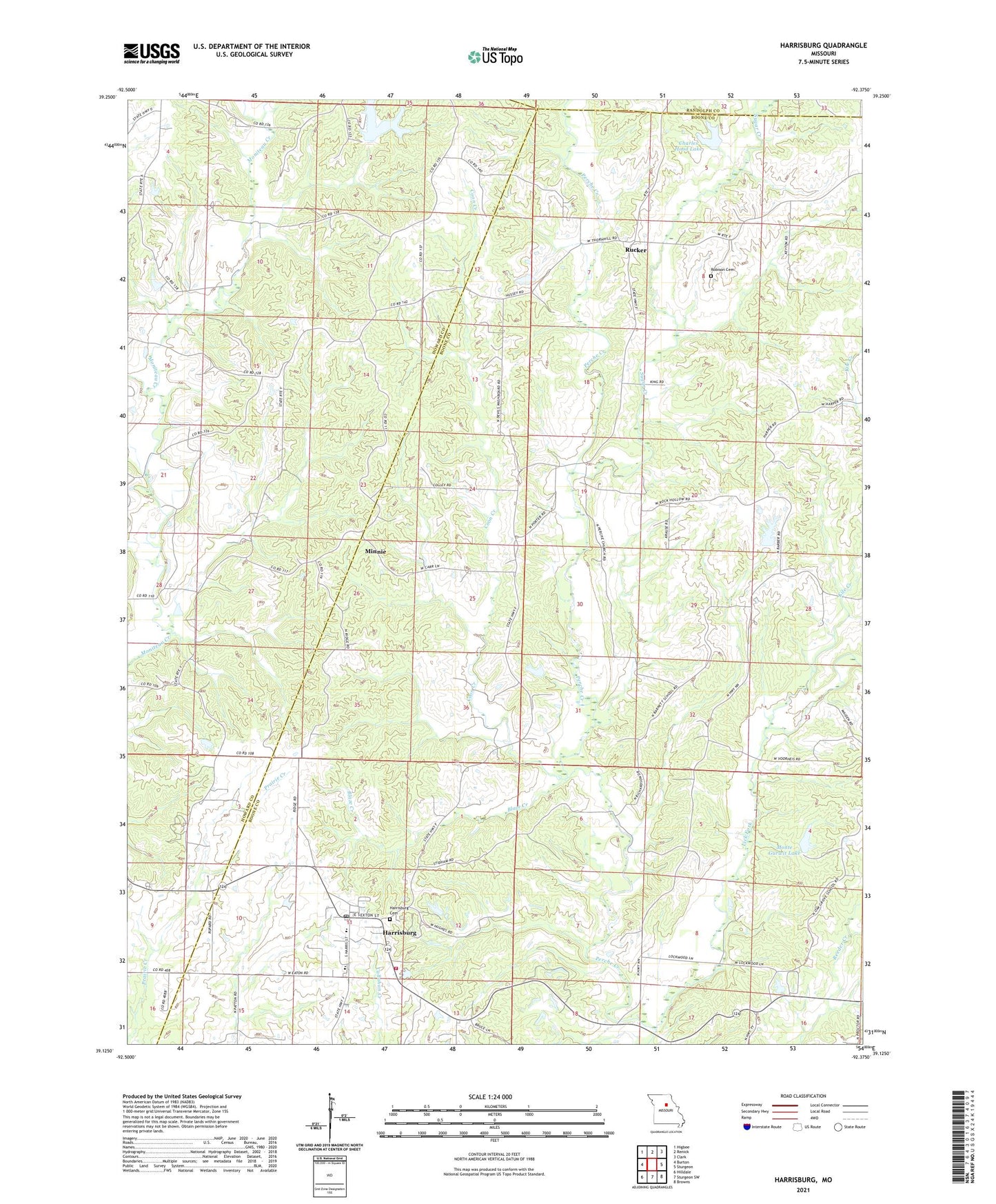
2021 topographic map quadrangle Harrisburg in the state of Missouri. Scale: 1:24000. Based on the newly updated USGS 7.5' US Topo map series, this map is in the following counties: Boone, Howard, Randolph. The map contains contour data, water features, and other items you are used to seeing on USGS maps, but also has updated roads and other features. This is the next generation of topographic maps. Printed on high-quality waterproof paper with UV fade-resistant inks.
Quads adjacent to this one:
West: Burton
Northwest: Higbee
North: Renick
Northeast: Clark
East: Sturgeon
Southeast: Browns
South: Sturgeon SW
Southwest: Hilldale
This map covers the same area as the classic USGS quad with code o39092b4.
Contains the following named places: Barnett School, Blakemore Lake Dam, Blaze Creek, Boone County Fire Protection District Station 4 - Harrisburg, Campbell Lake Dam, Charles Hood Lake, Coon Creek, Gurwit Lake Dam, Harrisburg, Harrisburg Cemetery, Harrisburg Elementary School, Harrisburg High School, Harrisburg Middle School, Harrisburg Post Office, Hood Lake Dam, Kile Creek, Lick Fork, Llorens Lake Dam, Lohmar Lake Dam, Minnie, Monte Gurwit Lake, Naylor School, Oak Grove School, Perche, Perche Church, Perche Post Office, Rileysburg, Robison Cemetery, Rucker, Rudolf Bennitt State Wildlife Area, Saint Clair School, Sugar Creek, Town of Harrisburg, White School