MyTopo
Hilldale Missouri US Topo Map
Couldn't load pickup availability
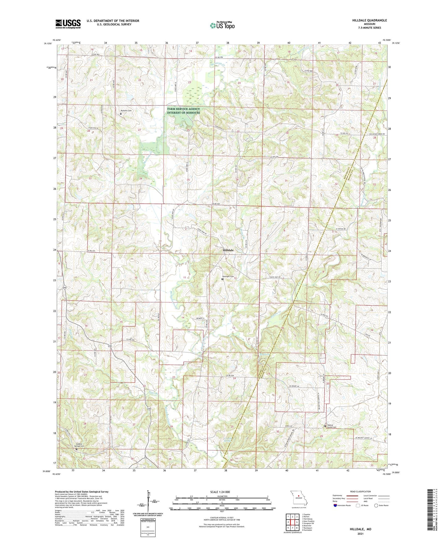
2021 topographic map quadrangle Hilldale in the state of Missouri. Scale: 1:24000. Based on the newly updated USGS 7.5' US Topo map series, this map is in the following counties: Howard, Boone. The map contains contour data, water features, and other items you are used to seeing on USGS maps, but also has updated roads and other features. This is the next generation of topographic maps. Printed on high-quality waterproof paper with UV fade-resistant inks.
Quads adjacent to this one:
West: New Franklin
Northwest: Fayette
North: Burton
Northeast: Harrisburg
East: Sturgeon SW
Southeast: Huntsdale
South: Rocheport
Southwest: Boonville
This map covers the same area as the classic USGS quad with code o39092a5.
Contains the following named places: Arnett School, Ashland Church, Big Spring, Big Spring Church, Caney Branch, Drake School, Hilldale, Hourigan Cemetery, Hungry Mother Creek, Hunters Creek, Jackson School, Landmark, Moniteau Chapel, Mount Arnold Church, Petersen Lake Dam, Pipes Branch, Prairie Creek, Rawlings School, Ricketts Cemetery, Shallow Lake, Smith Chapel, Sulphur Springs Church, Thralls Prairie, Township of Moniteau, U.S. Salt Springs, Union Church, Union School, Walnut Grove Cemetery, Walnut Grove School, Walnut Shade School, Whites Store, Wies Lake Dam, Wilhite, ZIP Code: 65279